National Register of Historic Places listings in Patrick County, Virginia facts for kids
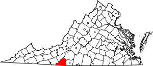
This is a list of the National Register of Historic Places listings in Patrick County, Virginia.
This is intended to be a complete list of the properties and districts on the National Register of Historic Places in Patrick County, Virginia, United States. The locations of National Register properties and districts for which the latitude and longitude coordinates are included below, may be seen in an online map.
There are 12 properties and districts listed on the National Register in the county, including 1 National Historic Landmark. Another property was once listed but has been removed.
Current listings
| Name on the Register | Image | Date listed | Location | City or town | Description | |
|---|---|---|---|---|---|---|
| 1 | Aurora |
(#91000015) |
VA 629 S of jct. with US 58 36°36′04″N 80°03′10″W / 36.601111°N 80.052778°W |
Penn's Store | ||
| 2 | Barnard Farm |
(#09000338) |
2878 VA 648 36°37′54″N 80°27′14″W / 36.631667°N 80.453889°W |
Ararat | ||
| 3 | Bluemont Presbyterian Church and Cemetery |
(#07000219) |
Blue Ridge Pkwy, Mile Post No. 192 36°39′30″N 80°34′24″W / 36.658333°N 80.573333°W |
Fancy Gap | ||
| 4 | Cockram Mill |
(#90001842) |
US 58 E of jct. with VA 632 36°44′12″N 80°22′56″W / 36.736667°N 80.382222°W |
Meadows of Dan | ||
| 5 | Goblintown Mill |
(#04001271) |
888 Iron Bridge Rd. 36°47′32″N 80°09′30″W / 36.792361°N 80.158472°W |
Stuart | ||
| 6 | Jack's Creek Covered Bridge |
(#73002050) |
About 2 mi. S of Woolwine off VA 8, over Jack 36°45′52″N 80°16′25″W / 36.764306°N 80.273611°W |
Woolwine | ||
| 7 | Mayberry Presbyterian Church |
(#07000225) |
1127 Mayberry Church Rd. 36°42′45″N 80°26′16″W / 36.712500°N 80.437778°W |
Meadows of Dan | ||
| 8 | Patrick County Courthouse |
(#74002142) |
SE corner of Main and Blue Ridge Sts. 36°38′32″N 80°16′11″W / 36.642222°N 80.269722°W |
Stuart | ||
| 9 | Reynolds Homestead |
(#71000987) |
N of Critz on VA 798 36°38′38″N 80°08′56″W / 36.643750°N 80.148889°W |
Critz | Also known as Rock Spring Plantation | |
| 10 | Stuart Uptown Historic District |
(#01001512) |
Main St. and Blue Ridge St. 36°38′30″N 80°16′12″W / 36.641667°N 80.270000°W |
Stuart | ||
| 11 | J.E.B. Stuart Birthplace |
(#98001161) |
N side of VA 773, W of jct. with VA 617 36°33′42″N 80°33′11″W / 36.561667°N 80.553056°W |
Ararat |
Former listings
| Name on the Register | Image | Date listed | Date removed | Location | City or town | Summary | |
|---|---|---|---|---|---|---|---|
| 1 | Bob White Covered Bridge |
(#73002049) |
|
About 2.5 miles (4.0 km) south of Woolwine off VA 618, over the Smith River 36°46′46″N 80°14′51″W / 36.779444°N 80.247500°W |
Woolwine |

All content from Kiddle encyclopedia articles (including the article images and facts) can be freely used under Attribution-ShareAlike license, unless stated otherwise. Cite this article:
National Register of Historic Places listings in Patrick County, Virginia Facts for Kids. Kiddle Encyclopedia.


