National Register of Historic Places listings in Marshall County, Iowa facts for kids
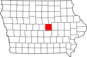
This is a list of the National Register of Historic Places listings in Marshall County, Iowa.
This is intended to be a complete list of the properties and districts on the National Register of Historic Places in Marshall County, Iowa, United States. Latitude and longitude coordinates are provided for many National Register properties and districts; these locations may be seen together in a map.
There are 16 properties and districts listed on the National Register in the county. Another property was once listed but has been removed.
| Name on the Register | Image | Date listed | Location | City or town | Description | |
|---|---|---|---|---|---|---|
| 1 | Thaddeus Binford House |
(#84001286) |
110 N. 2nd Ave. 42°03′04″N 92°54′34″W / 42.051111°N 92.909444°W |
Marshalltown | ||
| 2 | Dobbin Round Barn |
(#86001459) |
Off County Road S52 41°59′06″N 93°11′58″W / 41.985°N 93.199444°W |
State Center | ||
| 3 | Matthew Edel Blacksmith Shop and House |
(#83000391) |
1st St. and 3rd Ave. 41°56′42″N 92°57′40″W / 41.945°N 92.961111°W |
Haverhill | ||
| 4 | Glick-Sower House |
(#93000331) |
201 E. State St. 42°03′00″N 92°54′33″W / 42.05°N 92.909167°W |
Marshalltown | ||
| 5 | Le Grand Bridge (1896) |
(#98000481) |
Abbot Ave. over the Iowa River 42°01′54″N 92°45′58″W / 42.031667°N 92.766111°W |
Le Grand, in both Marshall and Tama counties | Profile from the Iowa Department of Transportation | |
| 6 | Le Grand Bridge (1914) |
(#98000499) |
County Road T37 over a backwater of the Iowa River 42°01′47″N 92°46′59″W / 42.029722°N 92.783056°W |
Le Grand | ||
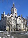
| 7 | Marshall County Courthouse |
(#72000478) |
Courthouse Sq. 42°02′55″N 92°54′42″W / 42.048611°N 92.911667°W |
Marshalltown | ||
| 8 | Marshalltown Downtown Historic District |
(#01001463) |
Roughly bounded by 2nd St., State St., 3rd. Ave., and E. Church St. 42°02′57″N 92°54′48″W / 42.049167°N 92.913333°W |
Marshalltown | ||
| 9 | Minerva Creek Bridge |
(#98000497) |
County Road S52 over Minerva Creek 42°08′21″N 93°09′21″W / 42.139167°N 93.155833°W |
Clemons | ||
| 10 | Quarry Bridge |
(#98000498) |
County Road I-4 over the Iowa River 42°01′35″N 92°48′29″W / 42.026389°N 92.808056°W |
Marshalltown | ||
| 11 | August and Josephine Riemenschneider Farmstead |
(#100007464) |
201 4th Ave. NE 42°01′08″N 93°09′31″W / 42.018822°N 93.158521°W |
State Center | ||
| 12 | State Center Commercial Historic District |
(#02001034) |
Blocks 200 and 100 of W. Main St. and 100 E. Main St. 42°00′58″N 93°09′51″W / 42.016111°N 93.164167°W |
State Center | ||
| 13 | Robert H. Sunday House |
(#88002141) |
1701 Woodfield Rd. 42°01′36″N 92°55′40″W / 42.026667°N 92.927778°W |
Marshalltown | ||
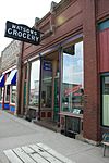
| 14 | Watson's Grocery |
(#98001271) |
106 Main St. 42°00′59″N 93°09′50″W / 42.016389°N 93.163889°W |
State Center | ||
| 15 | C.H. Whitehead House |
(#79000916) |
108 N. 3rd St. 42°02′57″N 92°55′22″W / 42.049167°N 92.922778°W |
Marshalltown | ||
| 16 | Leroy R. Willard House |
(#76000794) |
609 W. Main St. 42°02′57″N 92°55′22″W / 42.049167°N 92.922778°W |
Marshalltown |
Former listing
| Name on the Register | Image | Date listed | Date removed | Location | City or town | Summary | |
|---|---|---|---|---|---|---|---|
| 1 | First Church of Christ, Scientist |
(#79000915) |
|
412W. Main St. |
Marshalltown |

All content from Kiddle encyclopedia articles (including the article images and facts) can be freely used under Attribution-ShareAlike license, unless stated otherwise. Cite this article:
National Register of Historic Places listings in Marshall County, Iowa Facts for Kids. Kiddle Encyclopedia.


