National Register of Historic Places listings in Manassas, Virginia facts for kids
This is a list of the National Register of Historic Places listings in Manassas, Virginia.
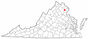
This is intended to be a complete list of the properties and districts on the National Register of Historic Places in the independent city of Manassas, Virginia, United States. The locations of National Register properties and districts for which the latitude and longitude coordinates are included below, may be seen in an online map.
There are 7 properties and districts listed on the National Register in the city.
Current listings
| Name on the Register | Image | Date listed | Location | Description | |
|---|---|---|---|---|---|
| 1 | Cannon Branch Fort |
(#99001004) |
10611 Gateway Boulevard 38°44′10″N 77°31′00″W / 38.736076°N 77.516788°W |
||
| 2 | Liberia |
(#80004215) |
8601 Portner Ave. 38°46′01″N 77°27′38″W / 38.766944°N 77.460556°W |
||
| 3 | Manassas Water Tower |
(#16000533) |
9000 Quarry St. 38°45′10″N 77°28′10″W / 38.752778°N 77.469444°W |
||
| 4 | Mayfield Fortification (44PW226) |
(#89001063) |
8401 Quarry Rd. 38°45′14″N 77°27′09″W / 38.753889°N 77.452500°W |
||
| 5 | Manassas Historic District |
(#88000747) |
Roughly bounded by Quarry Rd., Prescott and Fairview Aves., the former Southern railroad line, and Grant Ave. 38°45′06″N 77°28′19″W / 38.751667°N 77.471944°W |
||
| 6 | Manassas Industrial School for Colored Youth |
(#94000760) |
9601 Wellington Rd. 38°44′47″N 77°29′16″W / 38.746389°N 77.487778°W |

All content from Kiddle encyclopedia articles (including the article images and facts) can be freely used under Attribution-ShareAlike license, unless stated otherwise. Cite this article:
National Register of Historic Places listings in Manassas, Virginia Facts for Kids. Kiddle Encyclopedia.


