National Register of Historic Places listings in Madison County, Ohio facts for kids
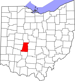
This is a list of the National Register of Historic Places listings in Madison County, Ohio.
This is intended to be a complete list of the properties and districts on the National Register of Historic Places in Madison County, Ohio, United States. The locations of National Register properties and districts for which the latitude and longitude coordinates are included below, may be seen in a Google map.
There are 11 properties and districts listed on the National Register in the county.
Current listings
| Name on the Register | Image | Date listed | Location | City or town | Description | |
|---|---|---|---|---|---|---|
| 1 | Cary Village Site |
(#75001479) |
Amid fields around the Cary Ditch, southeast of Plain City 40°04′49″N 83°14′46″W / 40.080333°N 83.246167°W |
Darby Township | ||
| 2 | Farmers National Bank |
(#95000168) |
Southwestern corner of the junction of Main and Chillicothe Sts. 40°06′27″N 83°16′03″W / 40.1075°N 83.2675°W |
Plain City | ||
| 3 | First United Methodist Church |
(#96000930) |
52 N. Main St. 39°53′14″N 83°26′59″W / 39.887222°N 83.449722°W |
London | ||
| 4 | London Commercial Business Historic District |
(#85003212) |
Roughly bounded by Adams, Superior and Clair Sts., Madison Ave., and Huron St. 39°53′05″N 83°26′49″W / 39.884722°N 83.446944°W |
London | ||
| 5 | Madison County Courthouse |
(#73001504) |
Public Sq. 39°53′12″N 83°26′57″W / 39.886667°N 83.449167°W |
London | ||
| 6 | Mount Sterling Historic District |
(#74001559) |
Both sides of London St. 39°43′12″N 83°15′54″W / 39.72°N 83.265°W |
Mount Sterling | ||
| 7 | Price Corners |
(#95000496) |
7040 U.S. Route 42 S., south of Plain City 40°02′42″N 83°17′54″W / 40.045°N 83.298333°W |
Canaan Township | ||
| 8 | Red Brick Tavern |
(#75001478) |
1700 Cumberland Rd. in Lafayette 39°56′16″N 83°24′24″W / 39.937778°N 83.406667°W |
Deer Creek Township | ||
| 9 | Skunk Hill Mounds |
(#74001560) |
On a ridge above the west bank of Little Darby Creek 39°55′53″N 83°16′00″W / 39.931458°N 83.266667°W |
Jefferson Township | Near West Jefferson | |
| 10 | Swetland House |
(#83002007) |
147 E. High St. 39°53′21″N 83°26′39″W / 39.889167°N 83.444167°W |
London | ||
| 11 | Valentine Wilson House |
(#73001505) |
About 1 mile north of Summerford off Interstate 70 39°56′35″N 83°30′21″W / 39.943056°N 83.505833°W |
Somerford Township |

All content from Kiddle encyclopedia articles (including the article images and facts) can be freely used under Attribution-ShareAlike license, unless stated otherwise. Cite this article:
National Register of Historic Places listings in Madison County, Ohio Facts for Kids. Kiddle Encyclopedia.


