National Register of Historic Places listings in LaGrange County, Indiana facts for kids
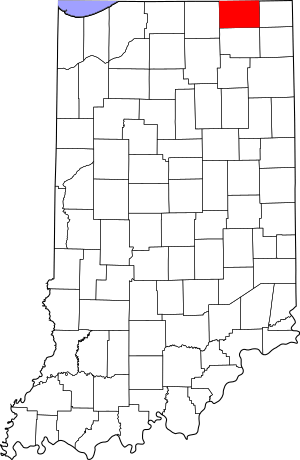
This is a list of the National Register of Historic Places listings in LaGrange County, Indiana.
This is intended to be a complete list of the properties and districts on the National Register of Historic Places in LaGrange County, Indiana, United States. Latitude and longitude coordinates are provided for many National Register properties and districts; these locations may be seen together in a map.
There are 8 properties and districts listed on the National Register in the county.
Another property was once listed but has been removed. Properties and districts located in incorporated areas display the name of the municipality, while properties and districts in unincorporated areas display the name of their civil township. Properties and districts split between multiple jurisdictions display the names of all jurisdictions.
Current listings
| Name on the Register | Image | Date listed | Location | City or town | Description | |
|---|---|---|---|---|---|---|
| 1 | John Badlam Howe Mansion |
(#95001106) |
W. Union St. at Howe 41°43′28″N 85°25′28″W / 41.724444°N 85.424444°W |
Lima Township | On the grounds of the Howe Military School. | |
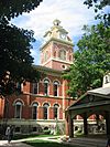
| 2 | La Grange County Courthouse |
(#80000042) |
Detroit St. 41°38′40″N 85°25′07″W / 41.644444°N 85.418611°W |
LaGrange | ||
| 3 | Olde Store (John O'Ferrell Store) |
(#75000024) |
West and 2nd Sts. at Mongo 41°41′08″N 85°16′46″W / 41.685556°N 85.279444°W |
Springfield Township | ||
| 4 | St. James Memorial Chapel |
(#01000989) |
State Road 9 at Howe, just south of County Road 600 N 41°43′28″N 85°25′29″W / 41.724444°N 85.424722°W |
Lima Township | On the grounds of the Howe Military School. | |
| 5 | Star Milling and Electric Company Historic District |
(#95001107) |
Junction of County Roads 505 W and 700 N, northeast of Howe 41°44′54″N 85°26′14″W / 41.748333°N 85.437222°W |
Lima Township | ||
| 6 | Samuel P. Williams House |
(#80000043) |
101 South St. at Howe 41°43′19″N 85°25′07″W / 41.721944°N 85.418611°W |
Lima Township | ||
| 7 | Menno Yoder Polygonal Barn |
(#93000191) |
8690 W250N, west of Shipshewana 41°40′30″N 85°35′47″W / 41.675000°N 85.596389°W |
Newbury Township |
Former listing
| Name on the Register | Image | Date listed | Date removed | Location | City or town | Summary | |
|---|---|---|---|---|---|---|---|
| 1 | Lima Township School |
(#85003193) |
|
Market and Broad Sts. |
Howe |


