National Register of Historic Places listings in Keokuk County, Iowa facts for kids
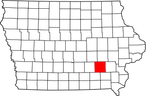
This is a list of the National Register of Historic Places listings in Keokuk County, Iowa.
This is intended to be a complete list of the properties and districts on the National Register of Historic Places in Keokuk County, Iowa. Latitude and longitude coordinates are provided for many National Register properties and districts; these locations may be seen together in a map.
There are 10 properties and districts listed on the National Register in the county.
| Name on the Register | Image | Date listed | Location | City or town | Description | |
|---|---|---|---|---|---|---|
| 1 | Bruce Goldfish Fisheries |
(#82002626) |
East of Thornburg off Iowa Highway 22 41°27′16″N 92°18′42″W / 41.454444°N 92.311667°W |
Thornburg | ||
| 2 | Keokuk County Courthouse |
(#81000251) |
Main St. 41°20′00″N 92°12′16″W / 41.333333°N 92.204444°W |
Sigourney | ||
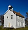
| 3 | Lancaster School |
(#84000010) |
Southeast of Sigourney 41°16′31″N 92°10′02″W / 41.275175°N 92.167284°W |
Sigourney | ||
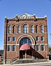
| 4 | Masonic Opera House |
(#73000733) |
201 Barnes St. 41°24′05″N 92°21′17″W / 41.401389°N 92.354722°W |
What Cheer | ||
| 5 | Public Square Historic District |
(#99000487) |
Roughly around the Keokuk County Courthouse 41°20′00″N 92°12′16″W / 41.333333°N 92.204444°W |
Sigourney | ||
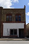
| 6 | Ramsey Building |
(#100000909) |
204 E. Broadway Ave. 41°21′49″N 91°57′12″W / 41.363589°N 91.953324°W |
Keota | ||
| 7 | Saints Peter and Paul Roman Catholic Church Historic District |
(#86002277) |
Southeast of Harper 41°18′19″N 92°00′20″W / 41.305278°N 92.005556°W |
Harper | ||
| 8 | Sigourney Public Library |
(#83000381) |
203 N. Jefferson St. 41°20′06″N 92°12′13″W / 41.334875°N 92.203675°W |
Sigourney | ||
| 9 | C.F. and Mary Singmaster House |
(#97001608) |
32263 190th St. 41°22′53″N 91°58′49″W / 41.381389°N 91.980278°W |
Keota | ||
| 10 | Theodore White House |
(#83000382) |
Broadway St. 41°26′59″N 92°05′24″W / 41.449722°N 92.09°W |
South English |
Former listings
| Name on the Register | Image | Date listed | Date removed | Location | City or town | Summary | |
|---|---|---|---|---|---|---|---|
| 1 | Delta Covered Bridge |
(#74000795) |
|
S of Delta off IA 108 across North Skunk River |
Delta vicinity | Destroyed by arsonist in 2003 | |
| 2 | Hayesville Independent School |
(#90001195) |
|
231 Washington St. 41°15′52″N 92°14′59″W / 41.264444°N 92.249722°W |
Hayesville | ||
| 3 | What Cheer City Hall |
(#81000252) |
|
Barnes and Washington Sts. |
What Cheer |

All content from Kiddle encyclopedia articles (including the article images and facts) can be freely used under Attribution-ShareAlike license, unless stated otherwise. Cite this article:
National Register of Historic Places listings in Keokuk County, Iowa Facts for Kids. Kiddle Encyclopedia.


