National Register of Historic Places listings in Kearney County, Nebraska facts for kids
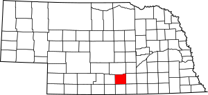
This is a list of the National Register of Historic Places listings in Kearney County, Nebraska. It is intended to be a complete list of the properties and districts on the National Register of Historic Places in Kearney County, Nebraska, United States. The locations of National Register properties and districts for which the latitude and longitude coordinates are included below, may be seen in an online map.
There are 8 properties and districts listed on the National Register in the county.
Current listings
| Name on the Register | Image | Date listed | Location | City or town | Description | |
|---|---|---|---|---|---|---|
| 1 | Bethphage Mission |
(#13000199) |
1044 23rd Road 40°29′13″N 99°07′16″W / 40.486829°N 99.121231°W |
Axtell vicinity | ||
| 2 | Eddie Eugene and Harriet Cotton Carpenter Farmstead |
(#93000059) |
Approximately 0.5 miles west of Lowell 40°38′54″N 98°51′31″W / 40.648333°N 98.858611°W |
Lowell | ||
| 3 | Dobytown |
(#74001125) |
Southwest of Kearney 40°38′30″N 99°02′51″W / 40.641667°N 99.047500°W |
Kearney | ||
| 4 | Fort Kearney |
(#71000485) |
2 miles west of Newark on Nebraska Highway 10 40°38′36″N 99°00′25″W / 40.643333°N 99.006944°W |
Newark | ||
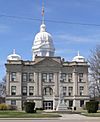
| 5 | Kearney County Courthouse |
(#89002234) |
5th St. between Colorado and Minden Aves. 40°29′56″N 98°56′53″W / 40.498889°N 98.948056°W |
Minden | ||
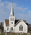
| 6 | Salem Swedish Methodist Episcopal Church |
(#82003192) |
Southwest of Axtell 40°27′11″N 99°10′42″W / 40.453056°N 99.178333°W |
Axtell | ||
| 7 | W. T. Thorne Building |
(#85002139) |
5th St. 40°29′59″N 98°56′54″W / 40.499722°N 98.948333°W |
Minden | ||
| 8 | US Post Office-Minden |
(#92000471) |
410 N. Minden St. 40°29′55″N 98°56′50″W / 40.498732°N 98.947358°W |
Minden | One of 12 Nebraska post offices featuring a Section of Fine Arts mural, "1848-Fort Kearney, Protectorate on the Overland Trail-1871" (1939) by William E. L. Bunn. |

All content from Kiddle encyclopedia articles (including the article images and facts) can be freely used under Attribution-ShareAlike license, unless stated otherwise. Cite this article:
National Register of Historic Places listings in Kearney County, Nebraska Facts for Kids. Kiddle Encyclopedia.


