National Register of Historic Places listings in Jersey County, Illinois facts for kids
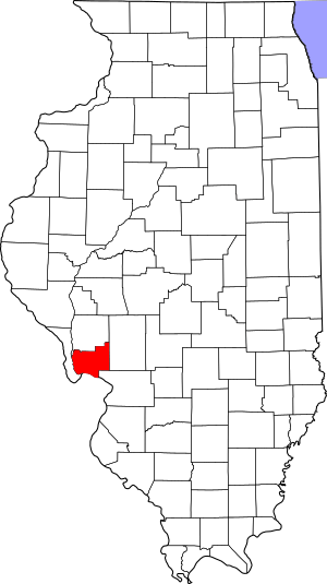
This is a list of the National Register of Historic Places listings in Jersey County, Illinois.
This is intended to be a complete list of the properties and districts on the National Register of Historic Places in Jersey County, Illinois, United States. Latitude and longitude coordinates are provided for many National Register properties and districts; these locations may be seen together in a map.
There are 21 properties and districts listed on the National Register in the county.
Current listings
| Name on the Register | Image | Date listed | Location | City or town | Description | |
|---|---|---|---|---|---|---|
| 1 | Charles Brainerd House |
(#98000065) |
420 E. Main St. (Illinois Route 100) 38°58′19″N 90°25′45″W / 38.971944°N 90.429167°W |
Grafton | ||
| 2 | Duncan Farm |
(#82002542) |
Southern side of Illinois Route 100, ½ mile west of Brussels Ferry 38°58′05″N 90°30′49″W / 38.968056°N 90.513611°W |
Grafton | ||
| 3 | Elsah Historic District |
(#73000706) |
North of the McAdams Highway 38°57′15″N 90°21′37″W / 38.954167°N 90.360189°W |
Elsah | ||
| 4 | Fisher-Chapman Farmstead |
(#12000028) |
24818 Homeridge Dr. 39°08′29″N 90°20′42″W / 39.141436°N 90.345116°W |
Jerseyville | ||
| 5 | Col. William H. Fulkerson Farmstead |
(#98000977) |
1510 N. State St. (US Highway 67) 39°08′52″N 90°20′54″W / 39.147778°N 90.348333°W |
Jerseyville | ||
| 6 | Grafton Bank |
(#94000016) |
225 E. Main St. (Illinois Route 100) 38°58′10″N 90°25′55″W / 38.969444°N 90.431944°W |
Grafton | ||
| 7 | Grafton Historic District |
(#94000020) |
105-225 and 24-214 W. Main St. (Illinois Route 100), and stone wharf at Maple St. 38°58′09″N 90°26′16″W / 38.969167°N 90.437778°W |
Grafton | ||
| 8 | Hamilton Primary School |
(#98000975) |
200 ft. west of the intersection of Otterville and McClusky Rds. 39°03′04″N 90°23′50″W / 39.051056°N 90.397295°W |
Otterville | ||
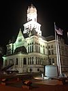
| 9 | Jersey County Courthouse |
(#86001008) |
Courthouse Square (bordered by W. Pearl, N. Lafayette, W. Exchange, and N. Washington Streets) 39°07′08″N 90°19′44″W / 39.118889°N 90.328889°W |
Jerseyville | ||
| 10 | Jerseyville Downtown Historic District |
(#86003528) |
Roughly bounded by Spruce, N. Lafayette, Prairie, and N. Jefferson Streets 39°07′07″N 90°19′41″W / 39.118611°N 90.328056°W |
Jerseyville | ||
| 11 | Paris Mason Building |
(#94000017) |
100 N. Springfield St. 38°58′17″N 90°27′01″W / 38.971389°N 90.450278°W |
Grafton | ||
| 12 | John and Amelia McClintock House |
(#94000019) |
321 E. Main St. (Illinois Route 100) 38°58′10″N 90°25′50″W / 38.969583°N 90.430417°W |
Grafton | ||
| 13 | New Piasa Chautauqua Historic District |
(#82002541) |
Off McAdams Parkway 38°57′57″N 90°23′05″W / 38.965833°N 90.384722°W |
Chautauqua | ||
| 14 | Nutwood Site |
(#79003784) |
Western side of Illinois Route 100, 500 feet south of the Narrows Creek bridge 39°04′54″N 90°33′23″W / 39.08166°N 90.55638°W |
Nutwood | ||
| 15 | Pere Marquette State Park Lodge and Cabins |
(#85002405) |
Box 158 38°58′18″N 90°32′28″W / 38.971667°N 90.541111°W |
Grafton | ||
| 16 | Principia College Historic District |
(#93001605) |
River Rd. 38°57′01″N 90°21′01″W / 38.950278°N 90.350278°W |
Elsah | ||
| 17 | Ruebel Hotel |
(#94000015) |
207-215 E. Main St. (Illinois Route 100) 38°58′11″N 90°25′56″W / 38.969722°N 90.432222°W |
Grafton | ||
| 18 | Slaten-LaMarsh House |
(#94000018) |
25 E. Main St. (Illinois Route 100) 38°58′10″N 90°26′03″W / 38.969444°N 90.434167°W |
Grafton | ||
| 19 | Smith-Duncan House and Eastman Barn |
(#99001379) |
Illinois Route 100 at Pere Marquette State Park, 2,000 feet (610 m) west of Deer Lick Hollow 38°58′09″N 90°30′43″W / 38.969167°N 90.511944°W |
Grafton |

All content from Kiddle encyclopedia articles (including the article images and facts) can be freely used under Attribution-ShareAlike license, unless stated otherwise. Cite this article:
National Register of Historic Places listings in Jersey County, Illinois Facts for Kids. Kiddle Encyclopedia.


