National Register of Historic Places listings in Henry County, Indiana facts for kids
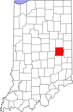
This is a list of the National Register of Historic Places listings in Henry County, Indiana.
This is intended to be a complete list of the properties and districts on the National Register of Historic Places in Henry County, Indiana, United States. Latitude and longitude coordinates are provided for many National Register properties and districts; these locations may be seen together in a map.
There are 15 properties and districts listed on the National Register in the county.
Properties and districts located in incorporated areas display the name of the municipality, while properties and districts in unincorporated areas display the name of their civil township. Properties and districts split between multiple jurisdictions display the names of all jurisdictions.
Current listings
| Name on the Register | Image | Date listed | Location | City or town | Description | |
|---|---|---|---|---|---|---|
| 1 | Chrysler Enclosure |
(#99001156) |
Western side of Ross St. at Chrysler High School 39°54′41″N 85°22′32″W / 39.911389°N 85.375556°W |
New Castle | ||
| 2 | Gen. William Grose House |
(#83000034) |
614 S. 14th St. 39°55′33″N 85°22′09″W / 39.925833°N 85.369167°W |
New Castle | ||
| 3 | Guyer Opera House |
(#79000018) |
U.S. Route 40 39°48′25″N 85°21′12″W / 39.806944°N 85.353333°W |
Lewisville | ||
| 4 | John W. Hedrick House |
(#84000491) |
506 High St. 40°03′22″N 85°32′01″W / 40.056111°N 85.533611°W |
Middletown | ||
| 5 | Henry County Courthouse |
(#81000013) |
Courthouse Sq. 39°55′51″N 85°22′16″W / 39.930833°N 85.371111°W |
New Castle | ||
| 6 | Elias Hinshaw House |
(#84001045) |
16 W. Main St. 39°47′43″N 85°31′42″W / 39.795278°N 85.528333°W |
Knightstown | ||
| 7 | Knightstown Academy |
(#76000022) |
Cary St. 39°48′00″N 85°31′29″W / 39.8°N 85.524722°W |
Knightstown | ||
| 8 | Knightstown Historic District |
(#86001104) |
Roughly bounded by Morgan, Adams, 3rd, and McCullum Sts. 39°47′46″N 85°31′38″W / 39.796111°N 85.527222°W |
Knightstown | ||
| 9 | Middletown Commercial Historic District |
(#10000122) |
Intersection of 5th and Locust Sts., stretching approximately 125 feet north and 180 feet south of Locust and one block west 40°03′15″N 85°32′00″W / 40.05425°N 85.533419°W |
Middletown | ||
| 10 | New Castle Archeological Site |
(#76000023) |
Grounds of the former New Castle State Hospital, southeast of the confluence of the Big and Little Blue Rivers, and northeast of New Castle 39°57′20″N 85°21′06″W / 39.955556°N 85.351667°W |
Henry Township | ||
| 11 | New Castle Commercial Historic District |
(#91001868) |
Roughly bounded by Fleming and 11th Sts., Central Ave. and the Norfolk Southern railroad tracks 39°55′53″N 85°22′12″W / 39.931389°N 85.37°W |
New Castle | ||
| 12 | Richsquare Friends Meetinghouse and Cemetery |
(#06000305) |
5685 S. 250E, north of Lewisville 39°51′10″N 85°20′29″W / 39.852778°N 85.341389°W |
Franklin Township | ||
| 13 | Henry F. Whitelock House and Farm |
(#83003565) |
State Road 38, north of Shirley 39°57′46″N 85°32′37″W / 39.962778°N 85.543611°W |
Harrison Township |


