National Register of Historic Places listings in Greenwood County, Kansas facts for kids
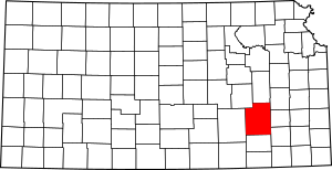
This is a list of the National Register of Historic Places listings in Greenwood County, Kansas.
This is intended to be a complete list of the properties on the National Register of Historic Places in Greenwood County, Kansas, United States. The locations of National Register properties for which the latitude and longitude coordinates are included below, may be seen in a map.
There are 16 properties listed on the National Register in the county.
Current listings
| Name on the Register | Image | Date listed | Location | City or town | Description | |
|---|---|---|---|---|---|---|
| 1 | Archeological Site Number 14GR320 |
(#82004880) |
Address restricted |
Fall River State Park | ||
| 2 | Curry Archeological Site |
(#74000838) |
Address restricted |
Madison | ||
| 3 | Eureka Atchison, Topeka and Santa Fe Railroad Depot |
(#12001119) |
416 E. 5th St. 37°49′25″N 96°17′21″W / 37.82361°N 96.28916°W |
Eureka | ||
| 4 | Eureka Carnegie Library |
(#88001170) |
520 N. Main 37°49′29″N 96°17′23″W / 37.824722°N 96.289722°W |
Eureka | ||
| 5 | Greenwood Hotel |
(#06000769) |
300 N. Main 37°49′17″N 96°17′36″W / 37.821389°N 96.293333°W |
Eureka | ||
| 6 | Paul Jones Building |
(#12000247) |
319 W. River St. 37°49′04″N 96°17′49″W / 37.817836°N 96.297078°W |
Eureka | part of the Roadside Kansas Multiple Property Submission (MPS) | |
| 7 | Lone Cone Site |
(#76000822) |
Address restricted |
Madison | ||
| 8 | Madison Atchison, Topeka and Santa Fe Railroad Depot |
(#91001774) |
Junction of 3rd and Boone Sts. 38°08′23″N 96°08′07″W / 38.139722°N 96.135278°W |
Madison | ||
| 9 | North Branch Otter Creek Bridge |
(#85001426) |
1 mile (1.6 km) west and 5 miles (8.0 km) north of Piedmont 37°41′28″N 96°22′46″W / 37.691111°N 96.379444°W |
Piedmont | ||
| 10 | Robertson House |
(#10001207) |
403 N. Plum 37°41′28″N 96°22′46″W / 37.691111°N 96.379444°W |
Eureka | ||
| 11 | Two Duck Site |
(#75000713) |
Address restricted |
Severy | ||
| 12 | US Post Office-Eureka |
(#89001637) |
301 N. Oak St. 37°49′20″N 96°17′51″W / 37.822222°N 96.2975°W |
Eureka | ||
| 13 | Verdigris River Bridge |
(#85001444) |
0.5 miles (0.80 km) north of Madison 38°08′46″N 96°08′19″W / 38.146111°N 96.138611°W |
Madison | ||
| 14 | Westside Service Station and Riverside Motel |
(#12000248) |
325 W. River St. 37°49′04″N 96°17′50″W / 37.817819°N 96.297174°W |
Eureka | part of the Roadside Kansas MPS |

All content from Kiddle encyclopedia articles (including the article images and facts) can be freely used under Attribution-ShareAlike license, unless stated otherwise. Cite this article:
National Register of Historic Places listings in Greenwood County, Kansas Facts for Kids. Kiddle Encyclopedia.


