National Register of Historic Places listings in Graham County, Arizona facts for kids
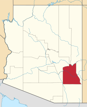
This is a list of the National Register of Historic Places listings in Graham County, Arizona. It is intended to be a complete list of the properties and districts on the National Register of Historic Places in Graham County, Arizona, United States. The locations of National Register properties and districts for which the latitude and longitude coordinates are included below, may be seen in a map.
There are 34 properties and districts listed on the National Register in the county, including 2 that are also National Historic Landmarks.
Current listings
| Name on the Register | Image | Date listed | Location | City or town | Description | |
|---|---|---|---|---|---|---|
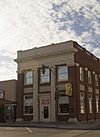
| 1 | Arizona Bank and Trust |
(#87002557) |
429 Main 32°49′59″N 109°42′42″W / 32.833056°N 109.711667°W |
Safford | ||
| 2 | Richard Bingham House |
(#87002556) |
1208 9th Ave. 32°49′34″N 109°43′05″W / 32.826222°N 109.718114°W |
Safford | ||
| 3 | Bonita Store |
(#98000172) |
1 mile northwest of the junction of State Route 266 and Arizona Industrial School Rd. 32°35′22″N 109°58′08″W / 32.589444°N 109.968889°W |
Bonita | ||
| 4 | Paul Brooks House |
(#87002559) |
1033 5th Ave. 32°49′40″N 109°42′44″W / 32.827885°N 109.712295°W |
Safford | ||
| 5 | Buena Vista Hotel |
(#87002560) |
322 Main 32°50′00″N 109°42′38″W / 32.833333°N 109.710556°W |
Safford | Fine example of Mission Revival architecture. But no longer extant. | |
| 6 | Columbine Work Station |
(#93000516) |
State Route 366 southwest of Safford in the Coronado National Forest 32°42′13″N 109°54′46″W / 32.703611°N 109.912778°W |
Safford | ||
| 7 | T. D. Cross House |
(#87002563) |
908 1st Ave. 32°49′47″N 109°42′28″W / 32.829657°N 109.707904°W |
Safford | ||
| 8 | William Charles Davis House |
(#87002565) |
301 11th St. 32°49′38″N 109°42′37″W / 32.827337°N 109.710283°W |
Safford | ||
| 9 | Graham County Courthouse |
(#82002077) |
800 Main St. 32°49′59″N 109°42′57″W / 32.833056°N 109.715833°W |
Safford | ||
| 10 | Heliograph Lookout Complex |
(#87002467) |
Coronado National Forest 32°39′00″N 109°50′56″W / 32.65°N 109.848889°W |
Old Columbine | ||
| 11 | Joe Horowitz House |
(#87002566) |
118 Main 32°50′01″N 109°42′31″W / 32.833512°N 109.708573°W |
Safford | ||
| 12 | House at 611 Third Avenue |
(#87002568) |
611 3rd Ave. 32°49′58″N 109°42′35″W / 32.832846°N 109.709736°W |
Safford | ||
| 13 | Kearny Campsite and Trail |
(#74000454) |
Northeast of Safford off U.S. Route 666 32°53′38″N 109°28′44″W / 32.893841°N 109.478996°W |
Safford | ||
| 14 | Marijilda Canyon Prehistoric Archeological District |
(#88001572) |
Address Restricted |
Safford | ||
| 15 | Mathew O'Brien House |
(#87002570) |
615 1st Ave. 32°49′57″N 109°42′26″W / 32.832505°N 109.707341°W |
Safford | ||
| 16 | Oak Draw Archeological District |
(#92001564) |
Address Restricted |
Safford | ||
| 17 | Oddfellows Home |
(#87002571) |
808 8th Ave. 32°49′49″N 109°43′00″W / 32.830407°N 109.716804°W |
Safford | ||
| 18 | George A. Olney House |
(#87002574) |
1104 Central 32°49′39″N 109°42′42″W / 32.827368°N 109.711544°W |
Safford | ||
| 19 | Alonzo Hamilton Packer House |
(#87002575) |
1203 Central 32°49′34″N 109°42′39″W / 32.826077°N 109.710956°W |
Safford | ||
| 20 | Point of Pines |
(#66000182) |
Address Restricted |
Morenci | ||
| 21 | Power's Cabin |
(#75000348) |
Northwest of Willcox in the Coronado National Forest 32°35′38″N 110°20′43″W / 32.593889°N 110.345278°W |
Willcox | Location of the 1918 Power's Cabin Shootout | |
| 22 | David Ridgeway House |
(#87002576) |
928 Central 32°49′46″N 109°42′42″W / 32.829474°N 109.711528°W |
Safford | ||
| 23 | Safford High School |
(#87002577) |
520 11th St. 32°49′41″N 109°42′47″W / 32.828056°N 109.713056°W |
Safford | School building built in 1915, listed on the National Register in 1988, and apparently razed in mid-1990s but still not yet delisted. | |
| 24 | Sierra Bonita Ranch |
(#66000181) |
Southwest of Bonita 32°30′36″N 110°02′15″W / 32.51°N 110.0375°W |
Bonita | Extends into Cochise County | |
| 25 | Southern Pacific Railroad Depot |
(#87002578) |
808 Central 32°49′52″N 109°42′42″W / 32.831099°N 109.711579°W |
Safford | ||
| 26 | Hugh Talley House |
(#87002580) |
1114 3rd Ave. 32°49′37″N 109°42′37″W / 32.826862°N 109.710299°W |
Safford | ||
| 27 | William Talley House |
(#87002581) |
219 11th St. 32°49′38″N 109°42′35″W / 32.827337°N 109.709788°W |
Safford | ||
| 28 | Webb Peak Lookout Tower |
(#87002464) |
Off State Route 366 32°42′41″N 109°55′19″W / 32.711389°N 109.921944°W |
Old Columbine | ||
| 29 | James R. Welker House |
(#87002582) |
1127 Central 32°49′36″N 109°42′39″W / 32.826563°N 109.710935°W |
Safford | ||
| 30 | West Peak Lookout Tower |
(#87002466) |
Coronado National Forest 32°44′15″N 110°02′15″W / 32.7375°N 110.0375°W |
Bonita | ||
| 31 | David Wickersham House |
(#87002583) |
1101 5th Ave. 32°49′38″N 109°42′43″W / 32.827258°N 109.712064°W |
Safford | ||
| 32 | Dan Williams House |
(#87002584) |
603 Relation 32°49′26″N 109°42′51″W / 32.823764°N 109.714059°W |
Safford | ||
| 33 | J. Mark Wilson House |
(#87002585) |
712 Relation 32°49′28″N 109°42′57″W / 32.824323°N 109.715893°W |
Safford | ||
| 34 | Woman's Club |
(#87002586) |
215 Main 32°49′59″N 109°42′33″W / 32.833056°N 109.709167°W |
Safford |

All content from Kiddle encyclopedia articles (including the article images and facts) can be freely used under Attribution-ShareAlike license, unless stated otherwise. Cite this article:
National Register of Historic Places listings in Graham County, Arizona Facts for Kids. Kiddle Encyclopedia.


