National Register of Historic Places listings in Gibson County, Indiana facts for kids
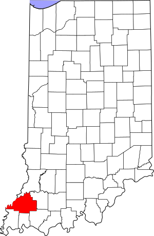
This is a list of the National Register of Historic Places listings in Gibson County, Indiana.
This is intended to be a complete list of the properties and districts on the National Register of Historic Places in Gibson County, Indiana, United States. Latitude and longitude coordinates are provided for many National Register properties and districts; these locations may be seen together in a map.
There are 9 properties and districts listed on the National Register in the county.
Properties and districts located in incorporated areas display the name of the municipality, while properties and districts in unincorporated areas display the name of their civil township. Properties and districts split between multiple jurisdictions display the names of all jurisdictions.
Current listings
| Name on the Register | Image | Date listed | Location | City or town | Description | |
|---|---|---|---|---|---|---|
| 1 | William M. Cockrum House |
(#78000031) |
627 W. Oak St. 38°20′15″N 87°21′13″W / 38.3375°N 87.353611°W |
Oakland City | ||
| 2 | Gibson County Courthouse |
(#84001038) |
Town Square 38°21′20″N 87°34′05″W / 38.355556°N 87.568056°W |
Princeton | ||
| 3 | Haubstadt State Bank |
(#84000489) |
101 S. Main St. 38°12′18″N 87°34′28″W / 38.205°N 87.574444°W |
Haubstadt | ||
| 4 | Lyles Consolidated School |
(#99001111) |
953 County Rd. 500 W 38°22′11″N 87°39′36″W / 38.369722°N 87.6601°W |
Patoka Township | ||
| 5 | Mussel Knoll Archeological Site (12GI11) |
(#86000454) |
Along the Wabash River in the middle of Section 14 in far northeastern Wabash Township, west of Skelton 38°20′25″N 87°49′22″W / 38.340278°N 87.822778°W |
Wabash Township | ||
| 6 | Patoka Bridges Historic District |
(#05000198) |
Along County Road 1250 E spanning the Patoka River, north of Oakland City 38°22′52″N 87°20′22″W / 38.381042°N 87.339347°W |
Columbia Township | Extends into Pike County | |
| 7 | Trippett-Glaze-Duncan-Kolb Farm |
(#93000470) |
State Road 65 east of Patoka; also the Kolb Farm, located along State Road 65 east of Patoka 38°24′15″N 87°31′45″W / 38.404167°N 87.529167°W |
Washington Township | The Kolb Farm represents a boundary increase of December 28, 2009 | |
| 8 | Weber Village Archaeological Site (12 Gi 13) |
(#85002131) |
North central portion of Section 18, about 0.25 miles (0.40 km) west of Skelton 38°20′36″N 87°47′29″W / 38.343333°N 87.791389°W |
Montgomery Township | ||
| 9 | Welborn-Ross House |
(#96000287) |
542 S. Hart St. 38°21′01″N 87°34′06″W / 38.350278°N 87.568333°W |
Princeton |


