National Register of Historic Places listings in Garfield County, Utah facts for kids
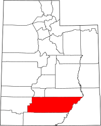
This is a list of the National Register of Historic Places listings in Garfield County, Utah.
This is intended to be a complete list of the properties and districts on the National Register of Historic Places in Garfield County, Utah, United States. Latitude and longitude coordinates are provided for many National Register properties and districts; these locations may be seen together in a map.
There are 27 properties and districts listed on the National Register in the county, including 1 National Historic Landmark.
Contents
Current listings
| Name on the Register | Image | Date listed | Location | City or town | Description | |
|---|---|---|---|---|---|---|
| 1 | Boulder Elementary School |
(#85000805) |
50 School House Ln. 37°54′32″N 111°25′22″W / 37.908889°N 111.422778°W |
Boulder | ||
| 2 | Bryce Canyon Airport |
(#78002660) |
Southeast of Panguitch off State Route 12 37°42′04″N 112°09′15″W / 37.701111°N 112.154167°W |
Panguitch | ||
| 3 | Bryce Canyon Lodge and Deluxe Cabins |
(#87001339) |
State Route 63 37°37′41″N 112°10′00″W / 37.628056°N 112.166667°W |
Bryce Canyon National Park | Expanded 1995 with regular NRHP overlay | |
| 4 | Bryce Canyon Lodge Historic District |
(#95000434) |
Bryce Canyon National Park 37°37′37″N 112°10′02″W / 37.626944°N 112.167222°W |
Bryce Canyon National Park | Expands district around Bryce Canyon Lodge, but is not National Historic Landmark-designated | |
| 5 | Bryce Canyon National Park Scenic Trails Historic District |
(#95000422) |
Bryce Canyon National Park 37°37′33″N 112°09′23″W / 37.625833°N 112.156389°W |
Bryce Canyon National Park | Comprises five contiguous trails: Navajo Loop Trail, Queen's Garden Trail, Peekaboo Loop Trail, Fairyland Loop Trail, Rim Trail | |
| 6 | Bryce Inn |
(#95000425) |
Bryce Canyon National Park 37°38′08″N 112°09′51″W / 37.635556°N 112.164167°W |
Bryce Canyon National Park | ||
| 7 | Coombs Village Site |
(#76001815) |
State Route 117 37°54′38″N 111°25′21″W / 37.910556°N 111.4225°W |
Boulder | A partially excavated Puebloan village, now part of Anasazi Indian State Park | |
| 8 | Escalante Historic District |
(#13000127) |
Roughly bounded by 300 North, 300 East, 300 South, 300 & 400 West Sts. 37°46′13″N 111°36′01″W / 37.77030278°N 111.6002944°W |
Escalante | ||
| 9 | Friendship Cove Pictograph |
(#78002659) |
Address Restricted |
Escalante | ||
| 10 | William Jasper, Jr., and Elizabeth Henderson House |
(#06000230) |
85 N. Main St. (Kodachrome Highway) 37°34′28″N 112°03′44″W / 37.574444°N 112.062222°W |
Cannonville | ||
| 11 | Hole-in-the-Rock Trail |
(#82004792) |
A trail commencing at Escalante and terminating at Bluff 37°25′18″N 110°39′51″W / 37.421667°N 110.664167°W |
Escalante | Split between Garfield, Kane, and San Juan counties | |
| 12 | Horse Barn |
(#95000433) |
Bryce Canyon National Park 37°37′35″N 112°10′53″W / 37.626389°N 112.181389°W |
Bryce Canyon National Park | ||
| 13 | Kolb Brothers "Cat Camp" Inscription |
(#88001250) |
Big Drop #2 vicinity, Canyonlands National Park 38°04′57″N 110°02′32″W / 38.0825°N 110.042222°W |
Moab | ||
| 14 | Loop C Comfort Station |
(#95000428) |
North Campground, Bryce Canyon National Park 37°38′10″N 112°09′54″W / 37.636111°N 112.165°W |
Bryce Canyon National Park | ||
| 15 | Loop D Comfort Station |
(#95000429) |
North Campground, Bryce Canyon National Park 37°38′05″N 112°09′58″W / 37.634722°N 112.166111°W |
Bryce Canyon National Park | ||
| 16 | Oak Creek Dam |
(#99001091) |
Oak Creek, north of North Coleman Canyon 38°05′00″N 111°08′15″W / 38.083333°N 111.1375°W |
Torrey | ||
| 17 | Old Administration Building |
(#95000430) |
Bryce Canyon National Park 37°37′53″N 112°09′52″W / 37.631389°N 112.164444°W |
Bryce Canyon National Park | ||
| 18 | Old National Park Service Housing Historic District |
(#95000424) |
Bryce Canyon National Park 37°37′50″N 112°10′06″W / 37.630556°N 112.168333°W |
Bryce Canyon National Park | ||
| 19 | William T., Jr., and Mary Isabell R. Owens House |
(#99000399) |
95 N. 100 East 37°49′26″N 112°26′00″W / 37.823889°N 112.433333°W |
Panguitch | ||
| 20 | Panguitch Carnegie Library |
(#84000148) |
75 E. Center St. 37°49′23″N 112°26′01″W / 37.823056°N 112.433611°W |
Panguitch | ||
| 21 | Panguitch Historic District |
(#06001068) |
Roughly bounded by 500 North, 400 East, 500 South, and 300 West 37°49′25″N 112°26′00″W / 37.823611°N 112.433333°W |
Panguitch | ||
| 22 | Panguitch Social Hall |
(#98001376) |
50 E. Center St. 37°49′21″N 112°25′58″W / 37.8225°N 112.432778°W |
Panguitch | ||
| 23 | Pole Hollow Archeological Site |
(#81000581) |
Address Restricted |
Panguitch | ||
| 24 | Starr Ranch |
(#76001816) |
15 miles (24 km) north of Ticaboo, off SR-276 37°51′03″N 110°39′53″W / 37.850833°N 110.664722°W |
Ticaboo | ||
| 25 | Under-the-Rim Trail |
(#95000423) |
Bryce Canyon National Park 37°33′44″N 112°12′57″W / 37.562222°N 112.215833°W |
Bryce Canyon National Park | ||
| 26 | Utah Parks Company Service Station |
(#95000426) |
Bryce Canyon National Park 37°37′45″N 112°09′59″W / 37.629167°N 112.166389°W |
Bryce Canyon National Park |

All content from Kiddle encyclopedia articles (including the article images and facts) can be freely used under Attribution-ShareAlike license, unless stated otherwise. Cite this article:
National Register of Historic Places listings in Garfield County, Utah Facts for Kids. Kiddle Encyclopedia.


