National Register of Historic Places listings in Franklin County, Iowa facts for kids
This is a list of the National Register of Historic Places listings in Franklin County, Iowa.
This is intended to be a complete list of the properties and districts on the National Register of Historic Places in Franklin County, Iowa, United States. Latitude and longitude coordinates are provided for many National Register properties and districts; these locations may be seen together in a map.
There are 12 properties and districts listed on the National Register in the county.
| Name on the Register | Image | Date listed | Location | City or town | Description | |
|---|---|---|---|---|---|---|
| 1 | Beeds Lake State Park, Civilian Conservation Corps Area |
(#90001672) |
Junction of Iowa Highways 3 and 134 42°46′15″N 93°14′21″W / 42.770833°N 93.239167°W |
Hampton | ||
| 2 | H.E. Boehmler House |
(#91001829) |
105 2nd St., SE. 42°44′26″N 93°12′18″W / 42.740556°N 93.205°W |
Hampton | ||
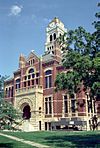
| 3 | Franklin County Courthouse |
(#76000772) |
Central Ave. and 1st St., NW. 42°44′29″N 93°12′32″W / 42.741389°N 93.208889°W |
Hampton | ||
| 4 | Franklin County G. A. R. Soldiers' Memorial Hall |
(#91001828) |
3 Federal St., N. 42°44′29″N 93°12′25″W / 42.741389°N 93.206944°W |
Hampton | ||
| 5 | Franklin County Sheriff's Residence and Jail |
(#96000896) |
18 E. Central Ave. 42°44′31″N 93°12′23″W / 42.741944°N 93.206389°W |
Hampton | ||
| 6 | Hampton Double Square Historic District |
(#03000834) |
Roughly bounded by 2nd Ave., 1st Ave., the alley west of 1st St., and the alley east of Federal 42°44′31″N 93°12′28″W / 42.741944°N 93.207778°W |
Hampton | ||
| 7 | Dr. O.B. Harriman House |
(#87000011) |
26 10th St., NW. 42°44′31″N 93°13′14″W / 42.741944°N 93.220556°W |
Hampton | ||
| 8 | Maysville Schoolhouse |
(#81000237) |
South of Hampton 42°40′00″N 93°12′11″W / 42.666667°N 93.203056°W |
Hampton | ||
| 9 | Reeve Electric Association Plant |
(#89002307) |
Rural Route 1 southwest of Hampton 42°41′14″N 93°13′58″W / 42.687222°N 93.232778°W |
Hampton | ||
| 10 | Leander Reeve House |
(#79000896) |
Southeast of Hampton on Iowa Highway 134 42°40′36″N 93°09′49″W / 42.676667°N 93.163611°W |
Hampton | ||
| 11 | St. John's Danish Evangelical Lutheran Church Historic District |
(#15000726) |
1207 Indigo Ave. 42°43′10″N 93°20′24″W / 42.719506°N 93.339903°W |
Hampton | ||
| 12 | Herman Wood Round Barn |
(#86001431) |
U.S. Route 65 42°33′28″N 93°15′02″W / 42.557778°N 93.250556°W |
Iowa Falls |

All content from Kiddle encyclopedia articles (including the article images and facts) can be freely used under Attribution-ShareAlike license, unless stated otherwise. Cite this article:
National Register of Historic Places listings in Franklin County, Iowa Facts for Kids. Kiddle Encyclopedia.


