National Register of Historic Places listings in Essex County, Virginia facts for kids
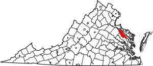
This is a list of the National Register of Historic Places listings in Essex County, Virginia.
This is intended to be a complete list of the properties and districts on the National Register of Historic Places in Essex County, Virginia, United States. The locations of National Register properties and districts for which the latitude and longitude coordinates are included below, may be seen in an online map.
There are 17 properties and districts listed on the National Register in the county.
Current listings
| Name on the Register | Image | Date listed | Location | City or town | Description | |
|---|---|---|---|---|---|---|
| 1 | Blandfield |
(#69000238) |
E of jct. of Rtes. 624 and U.S. 17 38°00′02″N 76°57′00″W / 38.000556°N 76.950000°W |
Caret | ||
| 2 | Brooke's Bank |
(#71000976) |
1 mi. E of Loretto, 1.4 mi. N of VA 17 38°05′29″N 77°01′05″W / 38.091389°N 77.018194°W |
Loretto | ||
| 3 | Cherry Walk |
(#83003280) |
S of Dunbrooke on VA 620 37°51′40″N 76°56′59″W / 37.861250°N 76.949722°W |
Dunbrooke | ||
| 4 | Edenetta |
(#16000796) |
6514 Tidewater Trail 38°03′47″N 77°01′23″W / 38.063056°N 77.023056°W |
Chance | ||
| 5 | Elmwood |
(#70000790) |
SW of jct. of Rtes. 640 and U.S. 17 38°05′07″N 77°05′39″W / 38.085389°N 77.094167°W |
Loretto | ||
| 6 | Glebe House of St. Anne's Parish |
(#75002020) |
2.5 mi. NE of Champlain on N bank of Farmers Hall Creek 38°01′58″N 76°57′13″W / 38.032639°N 76.953611°W |
Champlain | ||
| 7 | Glencairn |
(#79003036) |
N of Chance off U.S. 17 38°03′54″N 77°00′43″W / 38.065000°N 77.011806°W |
Chance | ||
| 8 | Linden |
(#92001397) |
US 17 SW side, 0.5 mi. S of Champlain 38°00′18″N 76°59′14″W / 38.005000°N 76.987222°W |
Champlain | ||
| 9 | Monte Verde |
(#02000586) |
405 Monte Verde Rd. 37°48′46″N 76°45′45″W / 37.812778°N 76.762389°W |
Center Cross | ||
| 10 | Port Micou |
(#91002041) |
VA 674, at Rappahannock R. 38°07′23″N 77°03′20″W / 38.122917°N 77.055556°W |
Loretto | ||
| 11 | St. Matthew's Church |
(#03001429) |
Jct. of VA 17, Virginia 631, and VA 724 38°00′57″N 76°59′32″W / 38.015833°N 76.992222°W |
Champlain | ||
| 12 | Tappahannock Historic District |
(#73002009) |
Roughly bounded by Queen St., Church Lane, Rappahannock River and the grounds of St. Margaret's School 37°55′39″N 76°51′31″W / 37.9275°N 76.858611°W |
Tappahannock | ||
| 13 | Vauter's Church |
(#72001391) |
1 mi. NW of Loretto on U.S. 17 38°05′13″N 77°04′07″W / 38.086944°N 77.068611°W |
Loretto | ||
| 14 | Wheatland |
(#89001918) |
VA 638 between US 17 and the Rappahanock River 38°05′24″N 77°02′07″W / 38.090000°N 77.035139°W |
Loretto | ||
| 15 | Woodlawn |
(#80004187) |
NE of Miller's Tavern 37°51′08″N 76°55′10″W / 37.852222°N 76.919361°W |
Miller's Tavern |

All content from Kiddle encyclopedia articles (including the article images and facts) can be freely used under Attribution-ShareAlike license, unless stated otherwise. Cite this article:
National Register of Historic Places listings in Essex County, Virginia Facts for Kids. Kiddle Encyclopedia.


