National Register of Historic Places listings in Cook County, Minnesota facts for kids
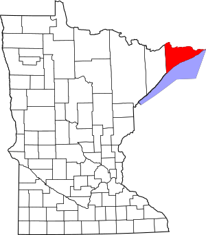
This is a list of the National Register of Historic Places listings in Cook County, Minnesota. It is intended to be a complete list of the properties and districts on the National Register of Historic Places in Cook County, Minnesota, United States. The locations of National Register properties and districts for which the latitude and longitude coordinates are included below, may be seen in an online map.
There are 14 properties and districts listed on the National Register in the county.
Current listings
| Name on the Register | Image | Date listed | Location | City or town | Description | |
|---|---|---|---|---|---|---|
| 1 | Amboy and George Spencer Shipwreck Sites |
(#94000341) |
Lake Superior shore about a mile southwest of Sugar Loaf Cove 47°28′41″N 90°59′59″W / 47.478089°N 90.999858°W |
Schroeder vicinity | Remains of an 1884 wooden bulk freighter and its 1874 schooner-barge consort, associated with the nationally significant Great Lakes iron ore trade and the infamous 1905 Mataafa Storm that sank them. | |
| 2 | Bally Blacksmith Shop |
(#86001548) |
Broadway and First Streets 47°45′03″N 90°19′58″W / 47.750712°N 90.332894°W |
Grand Marais | Rare intact and operational example of an early-20th-century blacksmith shop—built in 1911—and a representative of the utilitarian, false-front commercial buildings that once characterized Minnesota's small-town streetscapes. Now maintained by the Cook County Historical Society. | |
| 3 | Cascade River Wayside |
(#03000733) |
3481 Minnesota Highway 61 47°42′25″N 90°31′24″W / 47.706913°N 90.523296°W |
Cascade River State Park | Roadside park with eight contributing properties built 1936–38, representative of Minnesota's early state highway recreational development in collaboration with the National Park Service and the Civilian Conservation Corps. Also noted for its National Park Service rustic landscape architecture. | |
| 4 | Chik Wauk Lodge |
(#07000599) |
28 Moose Pond Road 48°10′08″N 90°52′51″W / 48.168778°N 90.880913°W |
Grand Marais vicinity | Well-preserved 1933 lodge representative of the rustic, family-owned fishing resorts that flourished in the Boundary Waters region from the 1920s to the early 60s. Now a museum and nature center. | |
| 5 | Church of St. Francis Xavier-Catholic |
(#86002119) |
Minnesota Highway 61 47°45′29″N 90°18′43″W / 47.758056°N 90.311944°W |
Grand Marais vicinity | 1895 church, one of Minnesota's few remaining 19th-century Indian missions and the only surviving structure of the Ojibwe settlement named Chippewa City. Now maintained by the Cook County Historical Society. | |
| 6 | Clearwater Lodge |
(#85003032) |
Off County Road 66 48°04′10″N 90°22′57″W / 48.069444°N 90.3825°W |
Grand Marais vicinity | Resort lodge built 1925–26, the oldest surviving guest accommodations in the Gunflint Trail area and a key representative of Cook County's tourism industry. | |
| 7 | Cook County Courthouse |
(#83000902) |
411 Second Street 47°45′09″N 90°20′21″W / 47.752439°N 90.339273°W |
Grand Marais | Courthouse built 1911–12, significant as the longstanding seat of Cook County's government and for its locally distinctive Neoclassical architecture. | |
| 8 | Fowl Lake Site |
(#74001013) |
Address restricted |
Hovland vicinity | Island site with rare Old Copper Complex resources, dating to around 3000 BCE; the region's most important archaeological site for this little-known Archaic period culture. | |
| 9 | Grand Portage National Monument |
(#66000111) |
Off Minnesota Highway 61 within Grand Portage Indian Reservation 47°57′45″N 89°41′05″W / 47.962435°N 89.684771°W |
Grand Portage vicinity | Partially reconstructed wilderness headquarters of the North West Company in use 1778–1802, plus the sites of a key portage and its terminal outpost; crucial sites associated with the North American fur trade and the exploration and colonization of the northwest. | |
| 10 | Height of Land |
(#74001012) |
Between North and South Lake in Superior National Forest 48°06′01″N 90°33′58″W / 48.100267°N 90.566037°W |
Grand Marais vicinity | 80-rod (1,300 ft; 400 m) portage on the Laurentian Divide, a key transition between upstream and downstream paddling for voyageurs of the fur trade era, who celebrated its crossing with a ritual rite of passage. | |
| 11 | Lightkeeper's House |
(#78001528) |
12 South Broadway 47°44′56″N 90°19′58″W / 47.74902°N 90.33272°W |
Grand Marais | 1896 lighthouse keeper's residence, representative of late-19th-century settlement on the North Shore and its dependence on Lake Superior. Now a historic house museum. | |
| 12 | Naniboujou Club Lodge |
(#82000558) |
Minnesota Highway 61 47°49′01″N 90°02′57″W / 47.816851°N 90.049278°W |
Grand Marais vicinity | Lodge built 1928–9 with unique Cree-inspired interior design, stemming from one of the most elaborate recreational developments planned in northern Minnesota. | |
| 13 | Schroeder Lumber Company Bunkhouse |
(#86002120) |
Minnesota Highway 61 47°32′34″N 90°53′42″W / 47.542686°N 90.894871°W |
Schroeder vicinity | Lumberjacks' bunkhouse built circa 1900, the last remaining structure of one of the North Shore's largest logging operations, active 1895–1905. | |
| 14 | Jim Scott Fishhouse |
(#86002904) |
Minnesota Highway 61 at Fifth Avenue 47°44′56″N 90°20′24″W / 47.748823°N 90.339965°W |
Grand Marais | 1907 processing and storage building representative of the important commercial fishing industry of the upper North Shore. |

All content from Kiddle encyclopedia articles (including the article images and facts) can be freely used under Attribution-ShareAlike license, unless stated otherwise. Cite this article:
National Register of Historic Places listings in Cook County, Minnesota Facts for Kids. Kiddle Encyclopedia.


