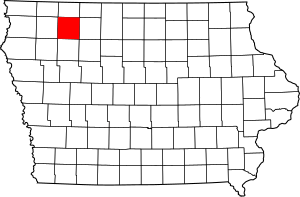
National Register of Historic Places listings in Clay County, Iowa facts for kids
This is a list of the National Register of Historic Places listings in Clay County, Iowa.
This is intended to be a complete list of the properties and districts on the National Register of Historic Places in Clay County, Iowa, United States. Latitude and longitude coordinates are provided for many National Register properties and districts; these locations may be seen together in a map.
There are 9 properties and districts listed on the National Register in the county.
Current listings
| Name on the Register | Image | Date listed | Location | City or town | Description | |
|---|---|---|---|---|---|---|
| 1 | Adams-Higgins House |
(#84001214) |
1215 N. Grand Ave. 43°09′01″N 95°08′45″W / 43.150222°N 95.145833°W |
Spencer | ||
| 2 | Clay County Courthouse |
(#81000229) |
W. 4th St. and 3rd Ave., W. 43°08′31″N 95°08′54″W / 43.141806°N 95.148222°W |
Spencer | ||
| 3 | Grand Avenue Historic Commercial District |
(#04001322) |
301-605 Grand Ave., 12-18, 21 W. 5th St., and 10, 13, and 15-19 W. 4th St. 43°08′35″N 95°08′41″W / 43.143056°N 95.144722°W |
Spencer | ||
| 4 | Philip and Anna Parrish Kirchner Log House |
(#93000897) |
4969 120th Ave. 42°55′42″N 95°20′48″W / 42.928333°N 95.346667°W |
Peterson | ||
| 5 | Little Sioux River Bridge |
(#98000810) |
210th Ave. over the Little Sioux River 43°09′47″N 95°10′13″W / 43.163056°N 95.170278°W |
Spencer | ||
| 6 | Logan Center School No.5 |
(#00001652) |
Junction of 420th St. and 310th Ave. 43°02′22″N 94°58′24″W / 43.039528°N 94.973389°W |
Dickens | ||
| 7 | North Grand Avenue Residential Historic District |
(#14000212) |
Roughly along N. Grand Ave. from 9th to 18th streets and between 1st Ave. W. and 1st Ave. E. 43°09′05″N 95°08′43″W / 43.151278°N 95.145389°W |
Spencer | ||
| 8 | Spencer High School and Auditorium |
(#10000002) |
104 E. 4th St. 43°08′29″N 95°08′35″W / 43.141394°N 95.143122°W |
Spencer | ||
| 9 | Wanata State Park Picnic Shelter |
(#90001677) |
South of the junction of County Road M27 and Iowa Highway 10 42°54′39″N 95°20′17″W / 42.910833°N 95.338056°W |
Peterson |
Former listings
| Name on the Register | Image | Date listed | Date removed | Location | City or town | Summary | |
|---|---|---|---|---|---|---|---|
| 1 | Seymour Ross Round Barn |
(#86001422) |
|
Off Iowa Highway 374 |
Gillett Grove | Demolished in 2002 |

All content from Kiddle encyclopedia articles (including the article images and facts) can be freely used under Attribution-ShareAlike license, unless stated otherwise. Cite this article:
National Register of Historic Places listings in Clay County, Iowa Facts for Kids. Kiddle Encyclopedia.


