National Register of Historic Places listings in Cherokee County, Kansas facts for kids
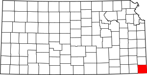
This is a list of the National Register of Historic Places listings in Cherokee County, Kansas.
This is intended to be a complete list of the properties and districts on the National Register of Historic Places in Cherokee County, Kansas, United States. The locations of National Register properties and districts for which the latitude and longitude coordinates are included below, may be seen in a map.
There are 12 properties and districts listed on the National Register in the county.
Current listings
| Name on the Register | Image | Date listed | Location | City or town | Description | |
|---|---|---|---|---|---|---|
| 1 | Baxter Springs High School |
(#14000479) |
1520 Cleveland Ave. 37°01′12″N 94°43′58″W / 37.0201°N 94.7329°W |
Baxter Springs | Now the middle school? | |
| 2 | Baxter Springs Independent Oil and Gas Service Station |
(#03000841) |
940 Military Ave. 37°01′33″N 94°44′05″W / 37.025833°N 94.734722°W |
Baxter Springs | ||
| 3 | Brush Creek Bridge |
(#83000419) |
North of Baxter Springs 37°04′24″N 94°44′26″W / 37.073333°N 94.740556°W |
Baxter Springs | Only surviving Marsh arch bridge on the entire length of the former U.S. Route 66 highway (this section is now a county highway) | |
| 4 | Columbus Public Carnegie Library |
(#87000932) |
205 N. Kansas 37°10′22″N 94°50′36″W / 37.172778°N 94.843333°W |
Columbus | ||
| 5 | Johnston Library |
(#76000817) |
210 W. 10th St. 37°01′35″N 94°44′12″W / 37.026389°N 94.736667°W |
Baxter Springs | ||
| 6 | Kansas Route 66 Historic District-East Galena |
(#03000842) |
U.S. Route 66 37°05′05″N 94°37′43″W / 37.084722°N 94.628611°W |
Galena | Includes part of U.S. Route 66 in Kansas | |
| 7 | Kansas Route 66 Historic District-North Baxter Springs |
(#15000141) |
N. Willow Ave., SE. 50th St.; also SE. Beasley Rd. 37°02′14″N 94°44′26″W / 37.0373°N 94.7406°W |
Baxter Springs | Second set of addresses represent a boundary increase listed January 11, 2017 | |
| 8 | Rial A. Niles House |
(#06000772) |
605 E. 12th St. 37°01′24″N 94°43′43″W / 37.023333°N 94.728611°W |
Baxter Springs | ||
| 9 | Edgar Backus Schermerhorn House |
(#89001146) |
803 E. 5th St. 37°04′35″N 94°37′53″W / 37.076389°N 94.631306°W |
Galena | ||
| 10 | Williams' Store |
(#03000843) |
7109 SE U.S. Route 66 37°04′30″N 94°42′10″W / 37.075°N 94.702778°W |
Riverton | Now known as Eisler Brothers Old Riverton Store. |

All content from Kiddle encyclopedia articles (including the article images and facts) can be freely used under Attribution-ShareAlike license, unless stated otherwise. Cite this article:
National Register of Historic Places listings in Cherokee County, Kansas Facts for Kids. Kiddle Encyclopedia.


