National Register of Historic Places listings in Cass County, Nebraska facts for kids
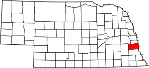
This is a list of the National Register of Historic Places listings in Cass County, Nebraska.
This is intended to be a complete list of the properties and districts on the National Register of Historic Places in Cass County, Nebraska, United States. The locations of National Register properties and districts for which the latitude and longitude coordinates are included below, may be seen in a map.
There are 31 properties and districts listed on the National Register in the county, including 1 National Historic Landmark.
Current listings
| Name on the Register | Image | Date listed | Location | City or town | Description | |
|---|---|---|---|---|---|---|
| 1 | Ashland Archeological Site |
(#75001090) |
Both sides of a small stream that meets Salt Creek immediately above its confluence with the Platte River 41°01′54″N 96°18′59″W / 41.031722°N 96.316389°W |
Ashland | ||
| 2 | Bridge |
(#92000707) |
County road over an unnamed stream, 4.7 miles (7.6 km) southeast of Louisville 40°58′22″N 96°04′55″W / 40.972778°N 96.081944°W |
Louisville | part of the Highway Bridges in Nebraska Multiple Property Submission (MPS) | |
| 3 | Cass County Courthouse |
(#89002248) |
Main St. between 3rd and 4th Sts. 41°00′42″N 95°53′01″W / 41.011667°N 95.8835°W |
Plattsmouth | part of the County Courthouses of Nebraska MPS | |
| 4 | Theodore Davis Site |
(#72000743) |
Address Restricted |
Weeping Water | ||
| 5 | The Elms |
(#77000824) |
204 East F Street 40°50′39″N 96°17′30″W / 40.84422°N 96.2918°W |
Elmwood | Home of author Bess Streeter Aldrich | |
| 6 | Paul Fitzgerald House |
(#06000100) |
513 E. 2nd St. 41°00′05″N 96°09′23″W / 41.00125°N 96.1565°W |
Louisville | ||
| 7 | Paul Gering House |
(#06000604) |
423 N. 6th St. 41°00′54″N 95°53′09″W / 41.01506°N 95.88586°W |
Plattsmouth | ||
| 8 | Gibson House |
(#86000471) |
107 Clinton 40°52′15″N 96°08′41″W / 40.87072°N 96.14475°W |
Weeping Water | ||
| 9 | Walker Gilmore Site (22CC28) |
(#66000441) |
Northeastern quarter of the northeastern quarter of Section 28, Township 11 North, Range 14 East 40°53′59″N 95°50′14″W / 40.899722°N 95.837222°W |
Murray | ||
| 10 | James and Margaret Greer Farmstead |
(#11000103) |
6315 202nd St. 40°53′18″N 96°26′49″W / 40.888333°N 96.446944°W |
Alvo | ||
| 11 | Kehlbeck Farmstead |
(#85002577) |
Address Restricted |
Avoca | ||
| 12 | Christian Kupke Farmstead |
(#12001073) |
32618 Church Rd. 40°57′27″N 96°14′54″W / 40.957507°N 96.248392°W |
Murdock | Operated under name "The Farm at Long Lane, LLC" | |
| 13 | Manley School |
(#04001414) |
115 Cherry St. 40°55′14″N 96°10′04″W / 40.9205°N 96.16772°W |
Manley | part of the School Buildings in Nebraska MPS | |
| 14 | McLaughlin-Waugh-Dovey House |
(#80002443) |
414 B Ave. 41°00′49″N 95°53′05″W / 41.01353°N 95.88464°W |
Plattsmouth | ||
| 15 | Naomi Institute |
(#77000825) |
3 miles (4.8 km) east of Murray 40°55′46″N 95°51′10″W / 40.92933°N 95.85289°W |
Murray | ||
| 16 | Nehawka Flint Quarries |
(#70000368) |
Address Restricted |
Nehawka | ||
| 17 | Nehawka Public Library |
(#02001481) |
Southeast corner of Elm and Maple Streets. 40°49′45″N 95°59′19″W / 40.82906°N 95.98853°W |
Nehawka | ||
| 18 | Capt. John O'Rourke House |
(#06000102) |
424 N. 6th St. 41°00′54″N 95°53′11″W / 41.01508°N 95.8865°W |
Plattsmouth | ||
| 19 | Glenn and Addie Perry Farmhouse |
(#06000999) |
Address Restricted |
Plattsmouth | ||
| 20 | Gottfried Gustav Pitz Barn |
(#12000564) |
903 Livingston Rd. 41°00′07″N 95°52′30″W / 41.00203°N 95.87509°W |
Plattsmouth | ||
| 21 | Plattsmouth Bridge |
(#92000755) |
U.S. Route 34 over the Missouri River 41°00′03″N 95°52′01″W / 41.00096°N 95.866836°W |
Plattsmouth | Extends into Mills County, Iowa; part of the Highway Bridges in Nebraska MPS | |
| 22 | Plattsmouth Main Street Historic District |
(#85002585) |
Main St. bounded by Avenue A, S. and N. 3rd St., 1st Ave. and S. and N. 7th St. 41°00′41″N 95°53′04″W / 41.011389°N 95.884444°W |
Plattsmouth | ||
| 23 | Peter E. Ruffner House |
(#16000105) |
501 N. 8th St. 41°00′56″N 95°53′18″W / 41.015585°N 95.888388°W |
Plattsmouth | ||
| 24 | Snoke Farmstead |
(#98000189) |
23416 O St., U.S. Highway 34 40°48′50″N 96°23′39″W / 40.813889°N 96.394167°W |
Eagle | ||
| 25 | Union Jail |
(#06000605) |
1st and Rock St. 40°48′44″N 95°55′23″W / 40.81236°N 95.92306°W |
Union | ||
| 26 | Weeping Water Historic District |
(#72000744) |
Randolph and H Sts. 40°52′16″N 96°08′32″W / 40.871111°N 96.142222°W |
Weeping Water | Consists of the 1870 Congregational Church, the Heritage House Museum, and the Jesse C. Fate Office. | |
| 27 | Young Cemetery Cabin |
(#04001408) |
Young Ln. E400 40°56′26″N 95°54′17″W / 40.94058°N 95.90469°W |
Plattsmouth |

All content from Kiddle encyclopedia articles (including the article images and facts) can be freely used under Attribution-ShareAlike license, unless stated otherwise. Cite this article:
National Register of Historic Places listings in Cass County, Nebraska Facts for Kids. Kiddle Encyclopedia.


