National Register of Historic Places listings in Brown County, Ohio facts for kids
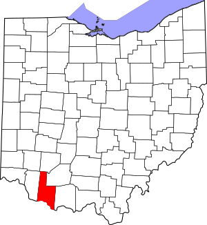
This is a list of the National Register of Historic Places listings in Brown County, Ohio.
This is intended to be a complete list of the properties and districts on the National Register of Historic Places in Brown County, Ohio, United States. The locations of National Register properties and districts for which the latitude and longitude coordinates are included below, may be seen in a Google map.
There are 26 properties and districts listed on the National Register in the county, including 3 National Historic Landmarks.
Current listings
| Name on the Register | Image | Date listed | Location | City or town | Description | |
|---|---|---|---|---|---|---|
| 1 | Aberdeen Mound |
(#74001401) |
Western side of State Route 41, north of Aberdeen 38°40′04″N 83°45′47″W / 38.667778°N 83.763056°W |
Huntington Township | ||
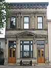
| 2 | Bailey-Thompson House |
(#76001373) |
112 N. Water St. 38°52′00″N 83°54′05″W / 38.866667°N 83.901389°W |
Georgetown | ||
| 3 | Dr. Philip Buckner House and Barn |
(#78002010) |
610 S. Main St. 38°51′39″N 83°54′18″W / 38.860833°N 83.905°W |
Georgetown | ||
| 4 | Burgett House and Barn |
(#78002013) |
West of Ripley on White Rd. 38°46′41″N 83°53′44″W / 38.778056°N 83.895556°W |
Union Township | ||
| 5 | Eagle Creek Covered Bridge |
(#75001324) |
3 mi (4.8 km) south of Decatur on State Route 763 38°40′24″N 83°44′57″W / 38.673333°N 83.749167°W |
Byrd Township | Washed away in 1997 | |
| 6 | Eagle Township Works I Mound |
(#71000630) |
0.5 miles (0.80 km) north of the junction of Fincastle and Mound Rds., east of Fincastle 38°59′15″N 83°41′47″W / 38.987500°N 83.696389°W |
Eagle Township | Near Fincastle | |
| 7 | Farmers Branch, State Bank of Ohio |
(#83001946) |
14 Front St. 38°44′44″N 83°50′48″W / 38.745556°N 83.846667°W |
Ripley | ||
| 8 | Georgetown Historic District |
(#78002011) |
Roughly bounded by Water Alley, Pleasant, Short, and State Sts. 38°51′58″N 83°54′15″W / 38.866043°N 83.904068°W |
Georgetown | ||
| 9 | Georgetown Public School |
(#90002215) |
307 W. Grant Ave. 38°51′56″N 83°54′26″W / 38.865556°N 83.907222°W |
Georgetown | ||
| 10 | Ulysses S. Grant Boyhood Home |
(#76001374) |
219 E. Grant Ave. 38°51′57″N 83°54′33″W / 38.865972°N 83.909144°W |
Georgetown | ||
| 11 | Higginsport School |
(#99001685) |
Junction of Jackson and Gaines Sts. 38°47′27″N 83°58′06″W / 38.790833°N 83.968333°W |
Higginsport | ||
| 12 | Henry Martin Farm |
(#75001326) |
2 mi (3.2 km) north of Ripley on U.S. Route 68 38°46′43″N 83°51′24″W / 38.778611°N 83.856667°W |
Union Township | ||
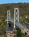
| 13 | Maysville-Aberdeen Bridge |
(#83002823) |
Spans the Ohio River between Aberdeen and Maysville, Kentucky 38°39′19″N 83°45′27″W / 38.655278°N 83.7575°W |
Aberdeen | Extends into Mason County, Kentucky | |
| 14 | Mount Orab Station |
(#75001325) |
N. Mill and Front Sts. 39°01′46″N 83°55′01″W / 39.029444°N 83.916944°W |
Mount Orab | ||
| 15 | Daniel Murphy Log House |
(#82003548) |
Anderson State Rd., southwest of St. Martin 39°12′19″N 83°54′24″W / 39.205278°N 83.906667°W |
Perry Township | ||
| 16 | John P. Parker House |
(#80002944) |
300 Front St. 38°45′00″N 83°50′58″W / 38.750000°N 83.849556°W |
Ripley | Designated a National Historic Landmark in 1997 | |
| 17 | Pisgah Christian Church |
(#80002945) |
Northwest of Ripley on Pisgah Ridge Rd. 38°46′57″N 83°52′48″W / 38.7825°N 83.88°W |
Union Township | ||
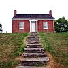
| 18 | John Rankin House |
(#70000485) |
East of downtown Ripley on Liberty Hill 38°45′02″N 83°50′36″W / 38.750556°N 83.843333°W |
Ripley | ||
| 19 | Red Oak Presbyterian Church |
(#82003547) |
Cemetery Rd., north of Ripley 38°47′44″N 83°47′44″W / 38.795556°N 83.795556°W |
Union Township | ||
| 20 | Ripley Historic District |
(#85000552) |
Roughly bounded by Main, Front, 2nd, 3rd and 4th Sts. 38°44′45″N 83°50′41″W / 38.74585°N 83.844652°W |
Ripley | ||
| 21 | Stonehurst |
(#75001327) |
2 mi (3.2 km) north of Ripley off U.S. Route 68 38°46′56″N 83°51′22″W / 38.782222°N 83.856111°W |
Union Township | ||
| 22 | Sutton House |
(#77001043) |
0.3 mi (0.48 km) east of Decatur on State Route 125 38°48′49″N 83°41′54″W / 38.813611°N 83.698333°W |
Byrd Township | Destroyed | |
| 23 | Thompson Farm |
(#76001375) |
West of Georgetown off State Route 221 38°51′58″N 83°55′23″W / 38.866111°N 83.923056°W |
Pleasant Township | ||
| 24 | Thompson-Bullock House |
(#78002012) |
West of Georgetown off State Route 221 38°51′59″N 83°55′23″W / 38.866389°N 83.923056°W |
Pleasant Township | ||
| 25 | Thumann Log House |
(#75001328) |
1 mi (1.6 km) south of St. Martin at the junction of U.S. Route 50 and State Route 251 39°11′28″N 83°53′51″W / 39.191111°N 83.897500°W |
Perry Township | ||
| 26 | Ursuline Center |
(#76001372) |
Northeast of Fayetteville off State Route 251 39°12′35″N 83°53′15″W / 39.209722°N 83.8875°W |
Perry Township |

All content from Kiddle encyclopedia articles (including the article images and facts) can be freely used under Attribution-ShareAlike license, unless stated otherwise. Cite this article:
National Register of Historic Places listings in Brown County, Ohio Facts for Kids. Kiddle Encyclopedia.


