National Register of Historic Places listings in Bristol, Virginia facts for kids
This is a list of the National Register of Historic Places listings in Bristol, Virginia.
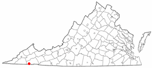
This is intended to be a complete list of the properties and districts on the National Register of Historic Places in the independent city of Bristol, Virginia, United States. The locations of National Register properties and districts for which the latitude and longitude coordinates are included below, may be seen in an online map.
There are 13 properties and districts listed on the National Register in the city.
Current listings
| Name on the Register | Image | Date listed | Location | Description | |
|---|---|---|---|---|---|
| 1 | Bristol Commercial Historic District |
(#03000441) |
Roughly along State, Piedmont, Moore, Shelby, Bank, Progress, 5th, 6th, 7th, and 8th Sts. 36°35′42″N 82°11′00″W / 36.595000°N 82.183333°W |
||
| 2 | Bristol Railroad Station |
(#80004173) |
State and Washington Sts. 36°35′44″N 82°10′48″W / 36.595556°N 82.180000°W |
||
| 3 | Bristol Virginia-Tennessee Slogan Sign |
(#88001568) |
E. State St. 36°35′42″N 82°10′46″W / 36.595000°N 82.179556°W |
||
| 4 | Bristol Warehouse Historic District |
(#12000273) |
Scott and Lee Sts. 36°35′53″N 82°10′53″W / 36.598056°N 82.181389°W |
||
| 5 | Douglass School |
(#04001592) |
711 Oakview Ave. 36°36′26″N 82°10′31″W / 36.607222°N 82.175278°W |
||
| 6 | East Hill Cemetery |
(#11000142) |
East State Street at Georgia Avenue 36°35′42″N 82°10′21″W / 36.595000°N 82.172500°W |
American Civil War-era cemetery with sections for Confederate soldiers and veterans as well as a small section for African American burials. Extends into Sullivan County, Tennessee | |
| 7 | Euclid Avenue Historic District |
(#06000369) |
Along Sect. of Arlington, Euclid, Fairmount, Glenway, Highland, Lawrence, Piedmont Aves., Chester, Grove, Lindsey 36°36′20″N 82°11′15″W / 36.605556°N 82.187500°W |
||
| 8 | First Baptist Church |
(#15000905) |
1 Virginia St. 36°35′42″N 82°10′41″W / 36.595000°N 82.178056°W |
||
| 9 | King-Lancaster-McCoy-Mitchell House |
(#94000793) |
54 King St. 36°35′50″N 82°11′10″W / 36.597222°N 82.186111°W |
||
| 10 | Solar Hill Historic District |
(#01000703) |
Roughly along Johnson, Solar, West, King, Cumberland, and Sycamore Sts. 36°35′57″N 82°11′06″W / 36.599167°N 82.185000°W |
||
| 11 | Virginia High School |
(#97000159) |
501 Piedmont Ave. 36°36′18″N 82°11′01″W / 36.605000°N 82.183611°W |
||
| 12 | Virginia Hill Historic District |
(#02001447) |
Sections of Moore, Lee, Russell, Clinton, Spencer, W. Mary and Buchanan Sts. 36°36′03″N 82°10′45″W / 36.600833°N 82.179167°W |
||
| 13 | Virginia Intermont College |
(#84000032) |
Moore and Harmeling Sts. 36°36′18″N 82°10′35″W / 36.605000°N 82.176389°W |

All content from Kiddle encyclopedia articles (including the article images and facts) can be freely used under Attribution-ShareAlike license, unless stated otherwise. Cite this article:
National Register of Historic Places listings in Bristol, Virginia Facts for Kids. Kiddle Encyclopedia.


