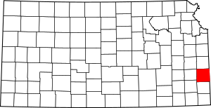
National Register of Historic Places listings in Bourbon County, Kansas facts for kids
This is a list of the National Register of Historic Places listings in Bourbon County, Kansas.
This is intended to be a complete list of the properties and districts on the National Register of Historic Places in Bourbon County, Kansas, United States. The locations of National Register properties and districts for which the latitude and longitude coordinates are included below, may be seen in a map.
There are 13 properties and districts listed on the National Register in the county.
Current listings
| Name on the Register | Image | Date listed | Location | City or town | Description | |
|---|---|---|---|---|---|---|
| 1 | First Congregational Church |
(#05000200) |
502 S. National Ave. 37°50′07″N 94°42′33″W / 37.835278°N 94.709167°W |
Fort Scott | ||
| 2 | First Presbyterian Church |
(#08000619) |
308 S. Crawford St. 37°50′19″N 94°42′35″W / 37.838611°N 94.709722°W |
Fort Scott | ||
| 3 | Fort Scott Downtown Historic District |
(#09001091) |
Oak to 3rd St. and Scott Ave. to National Ave. 37°50′27″N 94°42′22″W / 37.840906°N 94.706169°W |
Fort Scott | ||
| 4 | Fort Scott National Cemetery |
(#99000835) |
900 East National Ave. 37°49′18″N 94°41′36″W / 37.821667°N 94.693333°W |
Fort Scott | ||
| 5 | Fort Scott National Historic Site |
(#66000106) |
Old Fort Boulevard 37°50′38″N 94°42′17″W / 37.843889°N 94.704722°W |
Fort Scott | ||
| 6 | Fort Scott Public Carnegie Library |
(#87000930) |
201 S. National 37°50′25″N 94°42′23″W / 37.840278°N 94.706389°W |
Fort Scott | ||
| 7 | Fulton High School and Grade School |
(#15000688) |
408 W. Osage St. 38°00′34″N 94°43′16″W / 38.0095°N 94.7211°W |
Fulton | ||
| 8 | Long Shoals Bridge |
(#89002182) |
Over the Little Osage River east of Fulton 37°59′42″N 94°37′18″W / 37.995°N 94.621667°W |
Fulton | Metal Truss Bridges in Kansas 1861--1939 MPS apporoved for move 7/18/2012 |
|
| 9 | Marmaton Bridge |
(#82002652) |
1 mile northeast of Fort Scott 37°51′33″N 94°40′14″W / 37.859167°N 94.670556°W |
Fort Scott | ||
| 10 | Moody Building |
(#77000570) |
15 E. 2nd St. 37°50′24″N 94°42′22″W / 37.84°N 94.706111°W |
Fort Scott | ||
| 11 | Union Block |
(#72000489) |
24 S. Main St. 37°50′28″N 94°42′21″W / 37.841111°N 94.705833°W |
Fort Scott | ||
| 12 | Eugene Ware Elementary School |
(#05000552) |
900 E. 3rd St. 37°50′51″N 93°52′27″W / 37.8475°N 93.874167°W |
Fort Scott |

All content from Kiddle encyclopedia articles (including the article images and facts) can be freely used under Attribution-ShareAlike license, unless stated otherwise. Cite this article:
National Register of Historic Places listings in Bourbon County, Kansas Facts for Kids. Kiddle Encyclopedia.


