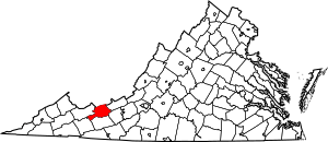
National Register of Historic Places listings in Bland County, Virginia facts for kids
This is a list of the National Register of Historic Places listings in Bland County, Virginia.
This is intended to be a complete list of the properties and districts on the National Register of Historic Places in Bland County, Virginia, United States. The locations of National Register properties and districts for which the latitude and longitude coordinates are included below, may be seen in a Google map.
There are 4 properties and districts listed on the National Register in the county.
Current listings
| Name on the Register | Image | Date listed | Location | City or town | Description | |
|---|---|---|---|---|---|---|
| 1 | Mountain Glen |
(#90002161) |
1 mile (1.6 km) southeast of Ceres 37°00′12″N 81°19′48″W / 37.003472°N 81.330000°W |
Ceres | ||
| 2 | Sharon Lutheran Church and Cemetery |
(#79003030) |
West of Ceres on State Route 42 37°00′59″N 81°20′57″W / 37.016389°N 81.349167°W |
Ceres | ||
| 3 | Junius Marcellus Updyke Farm |
(#12000018) |
4859 E. Bluegrass Trail 37°07′31″N 81°00′59″W / 37.125278°N 81.016389°W |
Bland | ||
| 4 | Wolf Creek Bridge |
(#10001114) |
Old SR 61 – Wolf Creek Rd. 37°14′36″N 81°06′09″W / 37.243333°N 81.102500°W |
Rocky Gap |

All content from Kiddle encyclopedia articles (including the article images and facts) can be freely used under Attribution-ShareAlike license, unless stated otherwise. Cite this article:
National Register of Historic Places listings in Bland County, Virginia Facts for Kids. Kiddle Encyclopedia.


