National Register of Historic Places listings in Adair County, Missouri facts for kids
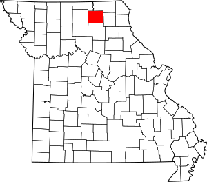
This is a list of the National Register of Historic Places listings in Adair County, Missouri.
This is intended to be a complete list of the properties and districts on the National Register of Historic Places in Adair County, Missouri, United States. Latitude and longitude coordinates are provided for many National Register properties and districts; these locations may be seen together in a map.
There are 20 properties and districts listed on the National Register in the county.
Current listings
| Name on the Register | Image | Date listed | Location | City or town | Description | |
|---|---|---|---|---|---|---|
| 1 | Adair County Courthouse |
(#78001636) |
Washington St. 40°11′42″N 92°35′01″W / 40.195°N 92.583611°W |
Kirksville | ||
| 2 | Bear Creek Baptist Church |
(#84002132) |
N of Kirksville off US 63 40°14′30″N 92°37′31″W / 40.241667°N 92.625278°W |
Kirksville | ||
| 3 | Cabins Historic District |
(#79001344) |
S of Novinger off MO 6 40°12′31″N 92°41′10″W / 40.208611°N 92.686111°W |
Novinger | ||
| 4 | Dockery Hotel |
(#83000971) |
Elson and McPherson Sts. 40°11′38″N 92°35′04″W / 40.193889°N 92.584444°W |
Kirksville | Demolished in 1991. | |
| 5 | Grim Building |
(#79001343) |
113-115 E. Washington St. 40°11′43″N 92°34′52″W / 40.195278°N 92.581111°W |
Kirksville | ||
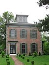
| 6 | Capt. Thomas C. Harris House |
(#73001034) |
1308 N. Franklin St. 40°12′19″N 92°34′56″W / 40.205278°N 92.582222°W |
Kirksville | ||
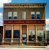
| 7 | Journal Printing Company Building |
(#11000439) |
119 S. Elson St. 40°11′40″N 92°35′03″W / 40.194444°N 92.584167°W |
Kirksville | ||
| 8 | Kirksville Courthouse Square Historic District |
(#09000330) |
200 block N. Franklin St., 100 block E. Harrison St., 100 block W. Harrison St. 40°11′44″N 92°34′59″W / 40.195564°N 92.583142°W |
Kirksville | ||
| 9 | Drs. George and Blanche Laughlin House |
(#14000047) |
706 S. Halliburton St. 40°11′22″N 92°34′37″W / 40.189492°N 92.577049°W |
Kirksville | ||
| 10 | Lincoln School |
(#100000606) |
907 S. Wabash St. 40°11′17″N 92°35′17″W / 40.188110°N 92.588038°W |
Kirksville | ||
| 11 | Masonic Temple |
(#09001208) |
217 E. Harrison St. 40°11′44″N 92°34′55″W / 40.195572°N 92.581883°W |
Kirksville | Egyptian Revival architecture | |
| 12 | St. Mary's Church |
(#74001069) |
On MO 11 40°15′08″N 92°22′27″W / 40.252222°N 92.374167°W |
Adair | Romanesque Revival architecture. | |
| 13 | Dr. E. Sanborn Smith House |
(#08001385) |
111 E. Patterson St. 40°11′11″N 92°34′59″W / 40.186375°N 92.583°W |
Kirksville | ||
| 14 | Orie J. Smith Black and White Stock Farm Historic District |
(#00001658) |
0.5 miles SE of Jct. of MO P and Co. Rd. 129B 40°13′32″N 92°33′33″W / 40.225556°N 92.559167°W |
Kirksville | ||
| 15 | Sojourners Club |
(#14000048) |
211 S. Elson St. 40°11′36″N 92°35′03″W / 40.193359°N 92.58403°W |
Kirksville | ||
| 16 | Thousand Hills State Park Petroglyphs Archeological Site |
(#70000320) |
W of Kirksville 40°11′12″N 92°38′28″W / 40.186667°N 92.641111°W |
Kirksville | Within Thousand Hills State Park | |
| 17 | Travelers Hotel |
(#09000718) |
301 W. Washington St. 40°11′41″N 92°35′07″W / 40.194678°N 92.58535°W |
Kirksville | ||
| 18 | Trinity Episcopal Church |
(#07001338) |
124 N Mulanix St. 40°11′50″N 92°34′47″W / 40.197222°N 92.579722°W |
Kirksville |

All content from Kiddle encyclopedia articles (including the article images and facts) can be freely used under Attribution-ShareAlike license, unless stated otherwise. Cite this article:
National Register of Historic Places listings in Adair County, Missouri Facts for Kids. Kiddle Encyclopedia.


