National Register of Historic Places listings in Accomack County, Virginia facts for kids
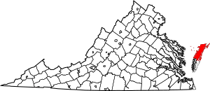
This is a list of the National Register of Historic Places listings in Accomack County, Virginia.
This is intended to be a complete list of the properties and districts on the National Register of Historic Places in Accomack County, Virginia, United States. The locations of National Register properties and districts for which the latitude and longitude coordinates are included below, may be seen in an online map.
There are 29 properties and districts listed on the National Register in the county. Another property was once listed but has been removed.
Current listings
| Name on the Register | Image | Date listed | Location | City or town | Description | |
|---|---|---|---|---|---|---|
| 1 | Accomac Historic District |
(#82004529) |
Business Rte. 13 37°43′11″N 75°40′11″W / 37.719722°N 75.669722°W |
Accomac | ||
| 2 | Arbuckle Place |
(#86001136) |
Seaside Rd./VA 679 37°52′27″N 75°31′37″W / 37.874167°N 75.526944°W |
Assawoman | ||
| 3 | Assateague Beach Coast Guard Station |
(#15000766) |
Beach Rd., Assateague Island National Seashore 37°51′51″N 75°22′05″W / 37.864167°N 75.368056°W |
Chincoteague | ||
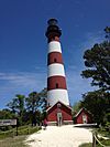
| 4 | Assateague Lighthouse |
(#73001989) |
S of Chincoteague at S end of Assateague Island 37°54′40″N 75°21′22″W / 37.911111°N 75.356111°W |
Chincoteague | ||
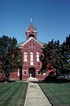
| 5 | Bank Building |
(#74002099) |
23321 Courthouse Avenue 37°43′10″N 75°40′15″W / 37.719583°N 75.670833°W |
Accomac | ||
| 6 | Edmund Bayly House |
(#82004530) |
VA 615 37°34′37″N 75°53′06″W / 37.577083°N 75.885000°W |
Craddockville | ||
| 7 | Bowman's Folly |
(#69000216) |
SE of jct. of Rtes. 652 and 13 37°41′45″N 75°37′29″W / 37.695833°N 75.624722°W |
Accomac | ||
| 8 | Bunting Place |
(#03000210) |
31181 Drummondtown Rd. 37°37′16″N 75°41′32″W / 37.621111°N 75.692222°W |
Wachapreague | ||
| 9 | Central High School |
(#10000561) |
32308 Lankford Hwy. 37°35′58″N 75°46′36″W / 37.599444°N 75.776667°W |
Painter | ||
| 10 | Cokesbury Church |
(#04001265) |
13 Market St. 37°42′43″N 75°45′08″W / 37.712083°N 75.752361°W |
Onancock | ||
| 11 | Debtors' Prison |
(#76002087) |
VA 764 37°43′13″N 75°40′15″W / 37.720278°N 75.670972°W |
Accomac | ||
| 12 | Captain Timothy Hill House |
(#11000547) |
5122 Main St. 37°56′49″N 75°21′25″W / 37.947083°N 75.357083°W |
Chincoteague Island | ||
| 13 | Hills Farm |
(#08000872) |
19065 Hills Farm Rd. 37°46′55″N 75°42′15″W / 37.781944°N 75.704167°W |
Greenbush | ||
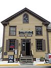
| 14 | Hopkins and Brother Store |
(#69000217) |
Market St. 37°42′43″N 75°45′19″W / 37.711944°N 75.755278°W |
Onancock | Est. 1842, served as bank and community meeting place; in 1970 deeded to Assoc. for the Preservation of Virginia Antiquities | |
| 15 | Locustville Academy |
(#16000792) |
28055 Drummondtown Rd. 37°39′29″N 75°40′30″W / 37.657917°N 75.675138°W |
Locustville | ||
| 16 | Kerr Place |
(#70000780) |
NE corner of Crockett Ave. and Market St. 37°42′47″N 75°44′49″W / 37.712917°N 75.746944°W |
Onancock | Built 1799-1802 by John Shepard Ker in Federal architecture style; originally called Ker's Place; Virginia Historic Landmark; now a museum and headquarters of Eastern Shore of Virginia Historical Society | |
| 17 | Mason House |
(#74002100) |
N of Guilford off VA 658 37°50′01″N 75°39′13″W / 37.833611°N 75.653611°W |
Guilford | ||
| 18 | Onancock Historic District |
(#92001266) |
Roughly bounded by Joynes Branch, Onancock Cr. and Lake, Kerr, Jackson, Market, Justice, Johnson and Holly Sts. 37°42′42″N 75°44′48″W / 37.711667°N 75.746667°W |
Onancock | ||
| 19 | Pitts Neck |
(#76002088) |
6 mi. W of New Church on VA 709 37°58′14″N 75°37′37″W / 37.970556°N 75.626944°W |
New Church | ||
| 20 | Pocomoke Farm |
(#07000054) |
7492 Monument Rd., Virginia 699 37°55′58″N 75°38′06″W / 37.932778°N 75.635000°W |
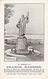
Sanford | Now known as Makemie Monument Park | |
| 21 | St. George's Church |
(#70000781) |
VA 178, NE of jct. with VA 180 37°38′02″N 75°48′38″W / 37.633889°N 75.810694°W |
Pungoteague | ||
| 22 | St. James Church |
(#69000215) |
Daugherty Rd. between Back St. and Ocean Hwy. 37°43′03″N 75°40′20″W / 37.717500°N 75.672222°W |
Accomac | ||
| 23 | Scarborough House Archaeological Site (44AC4) |
(#85001125) |
Scarborough Gut 37°33′41″N 75°54′42″W / 37.561389°N 75.911667°W |
Davis Wharf | Site of the estate house of Edmund Scarborough | |
| 24 | Shepherd's Plain |
(#82004531) |
W of Pungoteague 37°37′40″N 75°50′25″W / 37.627778°N 75.840278°W |
Pungoteague | ||
| 25 | Tangier Island Historic District |
(#14000384) |
most of Tangier Island; also area south of Tangier Island in Chesapeake Bay 37°49′39″N 75°59′32″W / 37.827500°N 75.992222°W |
Tangier | Boundary increase August 24, 2015 | |
| 26 | Wessells Root Cellar |
(#70000779) |
NE of jct. of Rtes. 701 and 692 37°53′54″N 75°37′34″W / 37.898333°N 75.626111°W |
Hallwood | ||
| 27 | Wharton Place |
(#72001378) |
0.7 mi. NE of jct. of VA 762 and 679 37°50′58″N 75°32′01″W / 37.849306°N 75.533611°W |
Mappsville | ||
| 28 | Willowdale |
(#07000401) |
18412 Willowdale Dr. 37°33′31″N 75°45′41″W / 37.558611°N 75.761389°W |
Painter |
Former listing
| Name on the Register | Image | Date listed | Date removed | Location | City or town | Summary | |
|---|---|---|---|---|---|---|---|
| 1 | Corbin Hall |
(#72001377) |
|
E of Horntown on VA 679 |
Horntown | Destroyed by fire in 2000 |

All content from Kiddle encyclopedia articles (including the article images and facts) can be freely used under Attribution-ShareAlike license, unless stated otherwise. Cite this article:
National Register of Historic Places listings in Accomack County, Virginia Facts for Kids. Kiddle Encyclopedia.

