Nashawena Island facts for kids
| Geography | |
|---|---|
| Coordinates | 41°25′45″N 70°52′28″W / 41.4292751°N 70.8744779°W |
| Archipelago | Elizabeth Islands |
| Total islands | 1 |
| Area | 2.732 sq mi (7.08 km2) |
| Highest elevation | 82 ft (25 m) |
| Administration | |
|
United States
|
|
| State | Massachusetts |
| County | Dukes County |
| The Elizabeth Islands |
|---|
 |
| Major Islands listed in order from east to west |
| Nonamesset Uncatena Naushon Pasque Nashawena Penikese Cuttyhunk |
| Minor Islands: |
| Bachelor Baret Bull Cedar Gosnold Gull Rock Veckatimest Weepecket Islands |
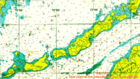
Nashawena Island is the second largest of the Elizabeth Islands of Dukes County, Massachusetts, United States. It lies between Cuttyhunk Island to the west and Pasque Island to the east. The island has a land area of 7.076 km² (2.732 sq mi, or 1,748.4 acres) and an official permanent population of 2 persons as of the 2000 U.S. Census.[1] The island is part of the town of Gosnold, Massachusetts. Nashawena is an Indian word meaning "middle island". Rock Island and Baret Island are two small islands located north of Nashawena.

All content from Kiddle encyclopedia articles (including the article images and facts) can be freely used under Attribution-ShareAlike license, unless stated otherwise. Cite this article:
Nashawena Island Facts for Kids. Kiddle Encyclopedia.


