Nampula Province facts for kids
Quick facts for kids
Nampula
|
|
|---|---|
 |
|

Nampula, Province of Mozambique
|
|
| Country | Mozambique |
| Capital | Nampula |
| Area | |
| • Total | 79,010 km2 (30,510 sq mi) |
| Population
(2017 census)
|
|
| • Total | 5,758,920 |
| • Density | 72.888/km2 (188.780/sq mi) |
| Postal code |
31xx
|
| Area code(s) | (+258) 26 |
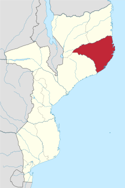
Nampula is a province in northern Mozambique. The capital city is also named Nampula.
The island Ilha de Moçambique, a UNESCO World Heritage Site, is part of the province.
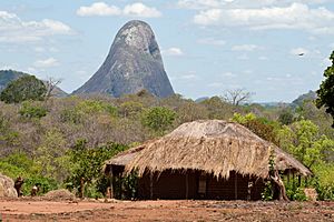
The Lúrio River forms the northern border. Mountains in the province include Mount Inago (1804 m), Mount Ribaue, Mount Panda and Mount Nairucu.
Districts
Nampula Province is divided into the 18 districts of:
- Angoche District
- Eráti District
- Lalaua District
- Malema District
- Meconta District
- Mecubúri District
- Memba District
- Mogincual District
- Mogovolas District
- Moma District
- Monapo District
- Mossuril District
- Muecate District
- Murrupula District
- Nacala-a-Velha District
- Nacarôa District
- Nampula District
- Ribáuè District
and the municipalities of:
- Angoche
- Ilha de Moçambique
- Monapo
- Nacala
- Nampula
Images for kids
See also
 In Spanish: Provincia de Nampula para niños

All content from Kiddle encyclopedia articles (including the article images and facts) can be freely used under Attribution-ShareAlike license, unless stated otherwise. Cite this article:
Nampula Province Facts for Kids. Kiddle Encyclopedia.


