Mynydd Tarw facts for kids
Quick facts for kids Mynydd Tarw |
|
|---|---|

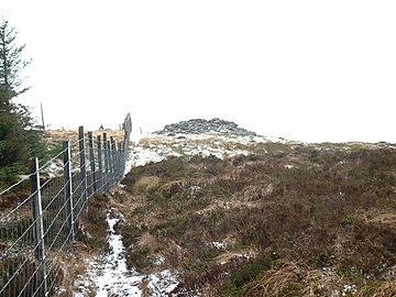
Cairn on Mynydd Tarw
|
|
| Highest point | |
| Elevation | 679 m (2,228 ft) |
| Prominence | 44 m (144 ft) |
| Listing | Hewitt, Nuttall |
| Naming | |
| English translation | mountain of the bull |
| Language of name | Welsh |
| Geography | |
| Location | Denbighshire / Powys, Wales |
| Parent range | Berwyn range |
| OS grid | SJ071323 |
| Topo map | OS Landranger 125 |
Mynydd Tarw is a subsidiary summit of Cadair Berwyn in north east Wales. It used to have a top: Rhos which has now been deleted as a Nuttall.
The summit has a large shelter cairn. The views are extensive, with the lower; northern and western Berwyns visible, including Pen Bwlch Llandrillo. Cadair Berwyn, Godor, Moel yr Ewig and Foel Wen are also in view.

All content from Kiddle encyclopedia articles (including the article images and facts) can be freely used under Attribution-ShareAlike license, unless stated otherwise. Cite this article:
Mynydd Tarw Facts for Kids. Kiddle Encyclopedia.