Murray-Darling Basin facts for kids
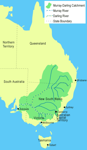
The Murray-Darling Basin is an area in Australia around the Murray and Darling Rivers. Three million Australians inside and outside the basin are directly dependent on its water.
About 6 per cent of Australia's total rainwater falls into the Murray-Darling Basin. About 85 per cent of all irrigation in Australia takes place in the basin, which supports an agricultural industry worth more than $9 billion per annum.
The Murray-Darling Basin covers 1,061,469 square kilometres (409,835 sq mi) or approximately one-seventh (14%) of the total area of Australia.
Over two million people live in the Basin.
Rivers in the Murray–Darling basin
-
Yarrawonga Weir on the Murray River forms Lake Mulwala, 2010
-
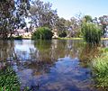
Darling River at Menindee, 2009
-
Warrego River at Cunnamulla, 2010
-
Barwon River at Collarenebri, 2008
-
Lake Burrendong, formed at the confluence of the Macquarie River and Cudgegong River, 1995
-
Macquarie River at Bathurst, 2009
-
Siphon irrigation of cotton on the Balonne River near St George, 2012
-
Maranoa River at Mitchell, 2005
-
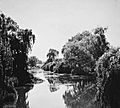
Macintyre River in flood at Goondiwindi, 1921
-
Taemas Bridge across the Murrumbidgee River, 2011
-
Goodradigbee River in the valley below the Brindabella Ranges, 2005
-
Molonglo River at Acton in 1920, prior to the damming of the river to form Lake Burley Griffin.
-
Wakool River, near Kyalite, 2012
-
A footbridge of the Avoca River at Charlton, 2005
-
Goulburn River at Murchison, 2009
-
Ovens River at Porepunkah, 2007
-
Mitta Mitta River, downstream from Dartmouth Dam, 2007
See also
 In Spanish: Cuenca del Murray-Darling para niños


