Mount Stromlo facts for kids

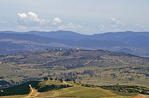
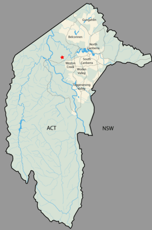
Mount Stromlo is west of the centre of Canberra, Australia, near the district of Weston Creek. It is about 751 m (2,464 ft) above sea level and 200 m (660 ft) above the surrounding plains. The Mount Stromlo Observatory (run by the Australian National University) is on the top of the mountain. Canberra's main water supply treatment plant, supplied by the Cotter River catchment area is nearby. Road access to the mountain is by Cotter Road on the south side, and Uriarra Road on the east and north. The summit is reached by a road joining Cotter road just outside Duffy.
History
The mountain had been part of the Yarralumla Station, a farm now used as the residence the Governor-General of Australia. It was named Mount Stromlo by Frederick Campbell in the 1880s, but it is not known where he got the name. Mount Stromlo was chosen by Pietro Baracchi in 1910 as the site for an observatory. The first telescope installed at Mount Stromlo was the Oddie telescope on 8 September 1911. The building housing this telescope was the first built by the Australian government in Canberra. In January 1913 the first telephone was connected to the Queanbeyan telephone exchange.
Mount Stromlo was burnt during bushfires in 2003. The fire burnt a pine plantation that covered the mountain, destroyed much of the observatory and water treatment plant.
Sport
Before the 2003 fires, Mount Stromlo had some of the best and oldest mountain bike trails in Australia. In May 2006 the trails were rebuilt and made bigger. Stromlo Forest Park now has more than 35 km of cross country single trail, a Four-Cross course, several observed trials areas and a downhill track. The 2009 Union Cycliste Internationale Mountain Bike and Trials World Championships were held at Mount Stromlo. About 30,000 visitors from up to 40 countries came to the event. More than 750 of the world's top riders took part in the four mountain bike sports of Cross Country, Downhill, Four Cross and Observed Trials.
Mount Stromlo also has a large building for events, with offices and change rooms. There is a children's play ground, barbecues, a road cycling circuit, a grass cross country running track and horse riding trails.
Geology
The rock on Mount Stromlo is ignimbrite from a volcanic eruption during the upper Silurian period. This is covering rhyodacite from a much earlier period, which can be seen on the surface on the lower slopes in the east and southeast sides. The northern lower slopes are covered with a calcareous shale also from the Silurian period. This is cut off on the northwest side by the Winslade Fault, which heads northeast to Cook and Kaleen. A spur fault heads off east from the Winslade Fault to under the Scrivener Dam. On the other side (northwest and north) of these faults are middle Silurian period rhyodacite volcanic deposits. The northern side has been uplifted compared with the southern side.
Landform
Stoney Creek and its tributaries drain the north side of the mountain, The east side drains into the Molonglo River. The south side supplies Blugar creek that runs into the Murrumbidgee River.
The top of the mountain near the observatory runs in a north-south direction with a spur running to the southwest where the water treatment plant is.
See also
 In Spanish: Monte Stromlo para niños


