Mount Ephraim, New Jersey facts for kids
Quick facts for kids
Mount Ephraim, New Jersey
|
||
|---|---|---|
|
Borough
|
||
|
||
| Motto(s):
"The Village at the Crossroads"
|
||

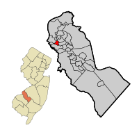
Mount Ephraim highlighted in Camden County. Inset: Camden County highlighted in the State of New Jersey.
|
||

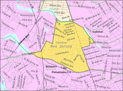
Census Bureau map of Mount Ephraim, New Jersey
|
||
| Country | ||
| State | ||
| County | Camden | |
| Incorporated | March 23, 1926 | |
| Named for | Ephraim Albertson | |
| Government | ||
| • Type | Walsh Act | |
| • Body | Board of Commissioners | |
| Area | ||
| • Total | 0.91 sq mi (2.34 km2) | |
| • Land | 0.88 sq mi (2.29 km2) | |
| • Water | 0.02 sq mi (0.05 km2) 2.31% | |
| Area rank | 514th of 565 in state 29th of 37 in county |
|
| Elevation | 30 ft (9 m) | |
| Population
(2020)
|
||
| • Total | 4,651 | |
| • Estimate
(2023)
|
4,654 | |
| • Rank | 390th of 565 in state 24th of 37 in county |
|
| • Density | 5,261.3/sq mi (2,031.4/km2) | |
| • Density rank | 107th of 565 in state 10th of 37 in county |
|
| Time zone | UTC−05:00 (Eastern (EST)) | |
| • Summer (DST) | UTC−04:00 (Eastern (EDT)) | |
| ZIP Code |
08059
|
|
| Area code(s) | 856 exchanges: 456, 742, 931, 933 | |
| FIPS code | 3400748750 | |
| GNIS feature ID | 0885313 | |
| Website | ||
Mount Ephraim is a borough in Camden County, in the U.S. state of New Jersey. As of the 2020 United States census, the borough's population was 4,651, a decrease of 25 (−0.5%) from the 2010 census count of 4,676, which in turn reflected an increase of 181 (+4.0%) from the 4,495 counted in the 2000 census.
The borough had the 20th-highest property tax rate in New Jersey with an equalized rate of 4.442% in 2020, compared to 3.470% in the county as a whole and a statewide average of 2.279%.
Contents
History
Mount Ephraim was authorized to incorporate as a borough by an act of the New Jersey Legislature on March 23, 1926, from portions of the now-defunct Centre Township, and then incorporated following a referendum on April 28, 1926, being the last borough to dissolve the former township. Acts authorizing the creation of the boroughs of Bellmawr, Runnemede and Lawnside were also passed during the same two-day period. The borough was named for Ephraim Albertson, who owned a tavern in the area in the early 1800s.
..... The decision cited the First Amendment rights of the storeowners.
In January 2014, New Jersey State Senate President Stephen M. Sweeney put forward a proposal which was intended to lower real estate taxes in the state and cut state expenses by merging many of the states 566 municipalities. Mount Ephraim was then the 29th largest town in Camden County, so it is very likely that the town would have been merged with neighboring municipalities to cut costs, share expenses, reduce bureaucracy, share resources, and reduce the burden in the taxpayers and the state itself. Mount Ephraim was formerly part of Centre Township, which included all of the neighboring communities, and it is possible that the name may be used again in the future if the merger proposal goes forward.
Geography
According to the United States Census Bureau, the borough had a total area of 0.900 square miles (2.332 km2), including 0.881 square miles (2.282 km2) of land and 0.019 square miles (0.050 km2) of water (2.16%).
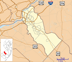
Mount Ephraim borders Audubon, Bellmawr, Brooklawn, Gloucester City, Haddon Heights and Haddon Township.
Weather
On September 4, 2012, at 6:31 p.m., a tornado touched down in Mount Ephraim, causing damage to trees and homes in the immediate vicinity. It was categorized as F-0 by the National Weather Service, with winds topping out at 70 mph, making it the first tornado recorded in the state in more than a year.
Demographics
| Historical population | |||
|---|---|---|---|
| Census | Pop. | %± | |
| 1930 | 2,319 | — | |
| 1940 | 2,282 | −1.6% | |
| 1950 | 4,449 | 95.0% | |
| 1960 | 5,447 | 22.4% | |
| 1970 | 5,625 | 3.3% | |
| 1980 | 4,863 | −13.5% | |
| 1990 | 4,517 | −7.1% | |
| 2000 | 4,495 | −0.5% | |
| 2010 | 4,676 | 4.0% | |
| 2020 | 4,651 | −0.5% | |
| 2023 (est.) | 4,654 | −0.5% | |
| Population sources: 1930–2000 1930 1940–2000 2000 2010 2020 |
|||
2010 census
The 2010 United States census counted 4,676 people, 1,909 households, and 1,193 families in the borough. The population density was 5,307.9 per square mile (2,049.4/km2). There were 2,010 housing units at an average density of 2,281.6 per square mile (880.9/km2). The racial makeup was 93.56% (4,375) White, 2.14% (100) Black or African American, 0.09% (4) Native American, 0.68% (32) Asian, 0.00% (0) Pacific Islander, 2.27% (106) from other races, and 1.26% (59) from two or more races. Hispanic or Latino of any race were 5.33% (249) of the population.
Of the 1,909 households, 26.6% had children under the age of 18; 45.6% were married couples living together; 11.5% had a female householder with no husband present and 37.5% were non-families. Of all households, 31.2% were made up of individuals and 13.7% had someone living alone who was 65 years of age or older. The average household size was 2.45 and the average family size was 3.11.
20.6% of the population were under the age of 18, 9.1% from 18 to 24, 26.5% from 25 to 44, 29.8% from 45 to 64, and 14.0% who were 65 years of age or older. The median age was 40.1 years. For every 100 females, the population had 93.4 males. For every 100 females ages 18 and older there were 92.4 males.
The Census Bureau's 2006–2010 American Community Survey showed that (in 2010 inflation-adjusted dollars) median household income was $61,331 (with a margin of error of +/− $6,103) and the median family income was $73,955 (+/− $4,630). Males had a median income of $51,049 (+/− $3,914) versus $41,087 (+/− $3,242) for females. The per capita income for the borough was $29,885 (+/− $5,190). About 5.6% of families and 6.8% of the population were below the poverty line, including 9.9% of those under age 18 and 10.4% of those age 65 or over.
Education
The Mount Ephraim Public Schools serve students in pre-kindergarten through eighth grade. As of the 2018–19 school year, the district, comprised of two schools, had an enrollment of 413 students and 38.0 classroom teachers (on an FTE basis), for a student–teacher ratio of 10.9:1. Schools in the district (with 2018–19 enrollment data from the National Center for Education Statistics) are Mary Bray Elementary School with 240 students in grades Pre-K–4 and Raymond W. Kershaw Middle School with 162 students in grades 5–8.
For ninth through twelfth grades, public school students attend Audubon High School, in Audubon, as part of a sending/receiving relationship with the Audubon School District. As of the 2018–19 school year, the high school had an enrollment of 804 students and 66.5 classroom teachers (on an FTE basis), for a student–teacher ratio of 12.1:1.
Transportation
Roads and highways
As of May 2010[update], the borough had a total of 16.67 miles (26.83 km) of roadways, of which 13.25 miles (21.32 km) were maintained by the municipality, 2.35 miles (3.78 km) by Camden County and 1.07 miles (1.72 km) by the New Jersey Department of Transportation.
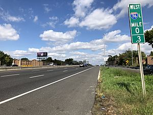
Interstate 76 passes through Mount Ephraim, with part of the interchange with Interstate 295 located within the borough.
Public transportation
Mount Ephraim is served by two NJ Transit bus lines. Service between the borough and Philadelphia is available on the 400 route, with local service on the 457 route between the Moorestown Mall and Camden.
Notable people
People who were born in, residents of, or otherwise closely associated with Mount Ephraim include:
- Dan Baker (born 1946), Philadelphia Phillies PA Announcer and former Philadelphia Eagles PA Announcer
- Bobby Clarke (born 1949), former Philadelphia Flyers hockey team captain and general manager
- Edith Fore, TV commercial actress for Life Alert, "I've fallen and I can't get up"
- Ben Vaughn, singer, songwriter, musician, record producer, composer for television / film, and syndicated radio show host
See also
 In Spanish: Mount Ephraim (Nueva Jersey) para niños


