Mount Coolon, Queensland facts for kids
Quick facts for kids Mount CoolonQueensland |
|||||||||||||||
|---|---|---|---|---|---|---|---|---|---|---|---|---|---|---|---|

Town of Mount Coolon, 1932
|
|||||||||||||||
| Population | 172 (2021 census) | ||||||||||||||
| • Density | 0.02828/km2 (0.0732/sq mi) | ||||||||||||||
| Postcode(s) | 4804 | ||||||||||||||
| Area | 6,081.0 km2 (2,347.9 sq mi) | ||||||||||||||
| Time zone | AEST (UTC+10:00) | ||||||||||||||
| Location |
|
||||||||||||||
| LGA(s) | Whitsunday Region | ||||||||||||||
| State electorate(s) | Burdekin | ||||||||||||||
| Federal Division(s) | Capricornia | ||||||||||||||
|
|||||||||||||||
Mount Coolon is a rural town and locality in the Whitsunday Region, Queensland, Australia. In the 2021 census, the locality of Mount Coolon had a population of 172 people.
Geography
The Suttor River rises here. The river marks part of the eastern and all of the southern and western boundaries of Mount Coolon. The Selheim River forms a small section of the northern border. The landscape is dotted with many waterholes and numerous peaks belonging to the Leichhardt Range.
History
Mount Coolon was originally called Koala but it was renamed after Thomas Coolon, a prospector who died following a claims dispute. Mount Coolon Post Office opened on 1 May 1925 (a receiving office had been open from 1922) and closed in 1984.
Demographics
In the 2011 census, the locality of Mount Coolon had a population of 567 people.
In the 2016 census, the locality of Mount Coolon had a population of 64 people.
In the 2021 census, the locality of Mount Coolon had a population of 172 people.
Heritage listings
Mount Coolon has a number of heritage-listed sites, including:
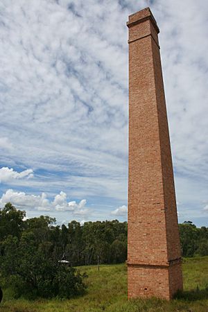
- Collinsville road (21°23′01″S 147°20′29″E / 21.3836°S 147.3415°E): Barclay's Battery
- St Annes Road (21°13′30″S 146°54′45″E / 21.225°S 146.9126°E): Suttor River Causeway on the Old Bowen Downs Road
Education
There are no schools in Mount Coolon. Glenden State School in Glenden to the east is the nearest government primary and secondary school; however, the distances involved in a daily commute mean that distance education and boarding schools are other options.
Amenities
Mount Coolon Hotel is at 1 Mill Street. It provides meals and accommodation.
The former Mount Coolon State School is now the Mount Coolon Community Centre.


