Moulins, Allier facts for kids
Quick facts for kids
Moulins
|
||
|---|---|---|
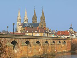
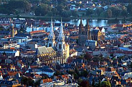
Moulins Cathedral.
|
||
|
||
| Country | France | |
| Region | Auvergne-Rhône-Alpes | |
| Department | Allier | |
| Arrondissement | Moulins | |
| Intercommunality | Moulins Communauté | |
| Area
1
|
8.61 km2 (3.32 sq mi) | |
| Population
(2014)
|
19,762 | |
| • Density | 2,295.2/km2 (5,945/sq mi) | |
| Demonym(s) | Moulinois | |
| Time zone | UTC+01:00 (CET) | |
| • Summer (DST) | UTC+02:00 (CEST) | |
| INSEE/Postal code |
03190 /03000
|
|
| Elevation | 202–240 m (663–787 ft) (avg. 221 m or 725 ft) |
|
| Website | www.ville-moulins.fr | |
| 1 French Land Register data, which excludes lakes, ponds, glaciers > 1 km2 (0.386 sq mi or 247 acres) and river estuaries. | ||
Moulins is a commune in the Allier department in the Auvergne-Rhône-Alpes region in central France.
It is the préfecture (capital) of the department and the historical capital of the old province of Bourbonnais (the Duchy of Bourbonnais).
Contents
History
Moulins experienced its golden age in the 15th century, when the Dukes of Bourbon lived in the city on the Allier river. The region of the northern Massif Central where is Moulins is called the Bourbonnais after the House of Bourbon.
Moulins became the capital of Allier on 4 March 1790 with the creation of the departments in France.
During the German occupation in the Second World War, the border between occupied France and the pro-German France (Vichy France) went through the midst of Moulins.
Geography
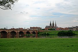
Moulins is along the Allier river, mainly on the right (eastern) side of the river. It has an area of 8.6 km2 (3.3 sq mi), and its average altitude is 221 m (725 ft); at the city hall, the altitude is 219 m (719 ft).
The distances from Moulins to other cities are:
- Paris, the national capital - 298 km (185 mi);
- Lyon, the regional capital - 204 km (127 mi);
- Reims - 422 km (262 mi);
- Bordeaux - 469 km (291 mi);
- Toulouse - 470 km (290 mi);
- Montpellier - 447 km (278 mi);
- Strasbourg - 514 km (319 mi);
- Nantes - 457 km (284 mi);
- Marseille - 514 km (319 mi).
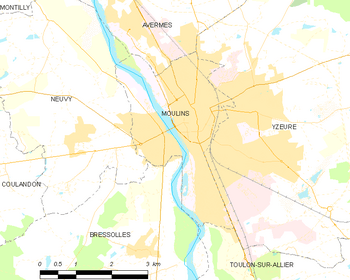 |
Moulins is surrounded by the communes Avermes, Yzeure, Toulon-sur-Allier, Bressolles and Neuvy.
 |
Neuvy | Avermes |  |
|
| Neuvy | Yzeure | |||
| Bressolles | Toulon-sur-Allier |
Climate
The climate of Moulins, in the Köppen climate classification, is Cfb - Oceanic climate with template summers.
Population
The inhabitants of Moulins are known, in French, as Moulinois (women: Moulinoises).
With a population of 19,762, Moulins has a population density of 2,295 inhabitants/km2.
Evolution of the population in Moulins

Administration
Moulins is the prefecture of the Allier department since 1800. It is also the capital of the arrondissement of Moulins and the administrative centre (French: chef-lieu) of two cantons:
- Moulins-1, formed by 6 communes and part of Moulins, with 18,030 inhabitants (2014).
- Moulins-2, formed by 22 communes and part of Moulins, with 19,368 inhabitants (2014).
It is part of the intercommunality Moulins Communauté (French: Communauté d'agglomération Moulins Communauté).
Sister cities
Moulins is twinned with:
Places of interest
Some interesting places in Moulins are:
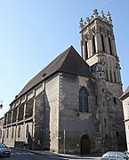
- The Moulins Cathedral Basilica (Cathédrale Notre-Dame-de-l'Annonciation de Moulins) is a Roman Catholic cathedral.
- The Anne de Beaujeu Museum is an art museum.
- The National Center of Costume and Scenography (Centre national du Costume de scène) is a museum dedicated to stage costumes and sets.
Gallery
- Coco Chanel, fashion designer, lived several years in Moulins.
Related pages
See also
 In Spanish: Moulins (Allier) para niños


