Moralzarzal facts for kids
Quick facts for kids
Moralzarzal
|
||
|---|---|---|
|
||
 |
||
| Country | ||
| Autonomous community | ||
| Province | Madrid | |
| Area | ||
| • Total | 42.6 km2 (16.4 sq mi) | |
| Elevation | 979 m (3,212 ft) | |
| Population
(2018)
|
||
| • Total | 12,697 | |
| • Density | 298.1/km2 (772.0/sq mi) | |
| Demonym(s) | cebollero/a | |
| Time zone | UTC+1 (CET) | |
| • Summer (DST) | UTC+2 (CEST) | |
| Postal code |
28411
|
|
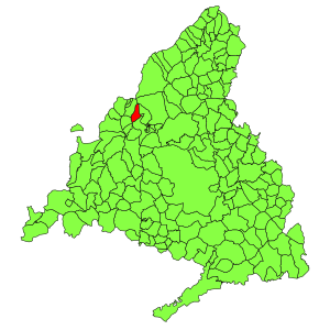
Moralzarzal is a town in Spain. It is located in the Sierra de Guadarrama, in the Community of Madrid. It had a population of 11,318 in 2008.
Public Transport
Moralzarzal has a big bus network. The bus lines going through Moralzarzal are the following:
- 670: Collado Villalba (Hospital)
- 671: Madrid (Moncloa)
- 672: Madrid (Moncloa) - Cerceda (by Mataelpino)
- 672A: Madrid (Moncloa) - Cerceda
- 720: Colmenar Viejo - Collado Villalba
- 876: Collado Villalba - Cerceda - Madrid (Plaza de Castilla)
- Night bus line 603: Moralzarzal - Villalba - Madrid (Moncloa)
See also
 In Spanish: Moralzarzal para niños

All content from Kiddle encyclopedia articles (including the article images and facts) can be freely used under Attribution-ShareAlike license, unless stated otherwise. Cite this article:
Moralzarzal Facts for Kids. Kiddle Encyclopedia.


