Montfoort facts for kids
Quick facts for kids
Montfoort
|
|||
|---|---|---|---|
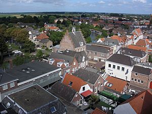
Montfoort city centre
|
|||
|
|||
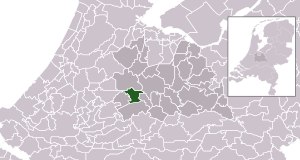
Location in Utrecht
|
|||
| Country | Netherlands | ||
| Province | Utrecht | ||
| Government | |||
| • Body | Municipal council | ||
| Area | |||
| • Total | 38.20 km2 (14.75 sq mi) | ||
| • Land | 37.69 km2 (14.55 sq mi) | ||
| • Water | 0.51 km2 (0.20 sq mi) | ||
| Elevation | 2 m (7 ft) | ||
| Population
(May 2014)
|
|||
| • Total | 13,653 | ||
| • Density | 362/km2 (940/sq mi) | ||
| Time zone | UTC+1 (CET) | ||
| • Summer (DST) | UTC+2 (CEST) | ||
| Postcode |
3417, 3460–3461
|
||
| Area code | 0348 | ||
Montfoort (Dutch pronunciation: [ˈmɔntfoːrt]) is a municipality and a city in the Netherlands, in the province of Utrecht. Montfoort received city rights in 1329.
Population centres
The municipality of Montfoort consists of the following cities, towns, villages and/or districts:
- Achthoven
- Achthoven-Oost
- Blokland
- Cattenbroek
- Heeswijk
- Knollemanshoek
- Linschoten
- Mastwijk
- Montfoort
- Willeskop
Topography
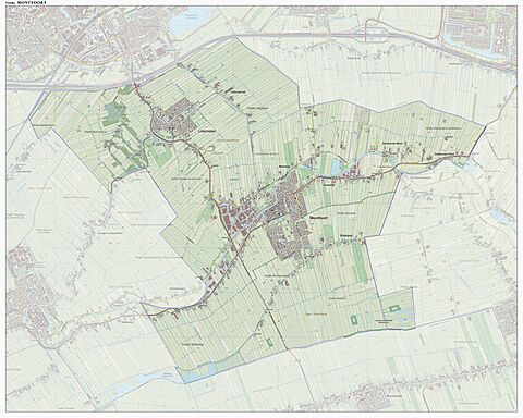
Dutch topographic map of the municipality of Montfoort, June 2015
Notable people
- Jan III van Montfoort (ca.1448 – 1522) a leader of the Hook Party in the Bishopric of Utrecht
- Anthonie Blocklandt van Montfoort (1533 or 1534 - 1583) a Dutch painter
- Isbrand van Diemerbroeck (1609–1674) a Dutch physician, anatomist and professor
- Matthew Maty (1718–1776) a physician and writer, secretary of the Royal Society and librarian of the British Museum
- Mark van Eldik (born 1967) a Dutch rally driver
Gallery
See also
 In Spanish: Montfoort para niños

All content from Kiddle encyclopedia articles (including the article images and facts) can be freely used under Attribution-ShareAlike license, unless stated otherwise. Cite this article:
Montfoort Facts for Kids. Kiddle Encyclopedia.


