Monsoon trough facts for kids
The monsoon trough is part of the Intertropical Convergence Zone (ITCZ) which extends into or through a monsoon circulation. It is shown on a weather map by a line showing the areas of lower barometric pressure.
Roles
In rainy season

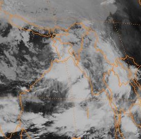
Since the monsoon trough is an area of convergence in the wind pattern, and an elongated area of low pressure at the surface, the trough focuses low level moisture and is defined by one or more elongated bands of thunderstorms when viewing satellite imagery. Its abrupt movement to the north between May and June is coincident with the beginning of the monsoon regime and rainy seasons across South and East Asia. This convergence zone has been linked to prolonged heavy rain events in the Yangtze river as well as northern China. Its presence has also been linked to the peak of the rainy season in locations within Australia. As it progresses poleward of a particular location, clear, hot, and dry conditions develop as winds become westerly. Many of the world's rainforests are associated with these climatological low-pressure systems.
In tropical cyclogenesis
A monsoon trough is a significant genesis region for tropical cyclones. Vorticity-rich low level environments, with significant low level spin, lead to a better than average chance of tropical cyclone formation due to their inherent rotation. This is because a pre-existing near-surface disturbance with sufficient spin and convergence is one of the six requirements for tropical cyclogenesis. There appears to be a 15- to 25-day cycle in thunderstorm activity associated with the monsoon trough, which is roughly half the wavelength of the Madden–Julian oscillation, or MJO. This mirrors tropical cyclone genesis near these features, as genesis clusters in 2–3 weeks of activity followed by 2–3 weeks of inactivity. Tropical cyclones can form in outbreaks around these features under special circumstances, tending to follow the next cyclone to its poleward and west.
Whenever the monsoon trough on the eastern side of the summertime Asian monsoon is in its normal orientation (oriented east-southeast to west-northwest), tropical cyclones along its periphery will move with a westward motion. If it is reverse oriented, or oriented southwest to northeast, tropical cyclones will move more poleward. Tropical cyclone tracks with S shapes tend to be associated with reverse-oriented monsoon troughs. The South Pacific convergence zone and South American convergence zones are generally reverse oriented. The failure of the monsoon trough, or the ITCZ, to move south of the equator in the eastern Pacific Ocean and Atlantic Ocean, during the southern hemisphere summer, is considered one of the reasons that tropical cyclones normally do not form in those regions. It has also been noted that when the monsoon trough lies near 20 degrees north latitude in the Pacific, the frequency of tropical cyclones is 2 to 3 times greater than when it lies closer to 10 degrees north.
Images for kids
-
August position of the ITCZ and monsoon trough in the Pacific Ocean, depicted by area of convergent streamlines in the northern Pacific


