Monroe County, Pennsylvania facts for kids
Quick facts for kids
Monroe County
|
||
|---|---|---|
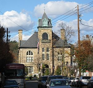
Monroe County Courthouse in Stroudsburg in November 2009
|
||
|
||
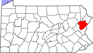
Location within the U.S. state of Pennsylvania
|
||
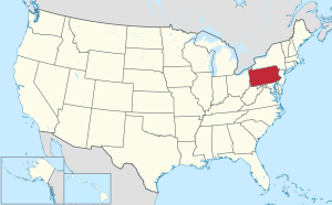 Pennsylvania's location within the U.S. |
||
| Country | ||
| State | ||
| Founded | April 1, 1836 | |
| Named for | James Monroe 270 | |
| Seat | Stroudsburg | |
| Largest township | Coolbaugh Township | |
| Area | ||
| • Total | 617 sq mi (1,600 km2) | |
| • Land | 608 sq mi (1,570 km2) | |
| • Water | 9.0 sq mi (23 km2) 1.5%% | |
| Population
(2020)
|
||
| • Total | 168,327 |
|
| • Density | 270/sq mi (100/km2) | |
| Time zone | UTC−5 (Eastern) | |
| • Summer (DST) | UTC−4 (EDT) | |
| Congressional districts | 7th, 8th | |
| Website | http://www.monroecountypa.gov | |
Monroe County is a county in the Commonwealth of Pennsylvania. As of the 2020 census, the population was 168,327. Its county seat is Stroudsburg. The county is part of the Northeast Pennsylvania region of the state. The county was formed from sections of Northampton and Pike counties on April 1, 1836. It was named in honor of James Monroe, the fifth president of the United States. The county borders Northampton County and the Lehigh Valley to its south, Pike and Wayne counties to its north, Carbon and Luzerne counties to its west, and the Delaware River and Warren County, New Jersey to its east. It is part of the New York metropolitan area, but also receives media from the Scranton/Wilkes-Barre and Philadelphia radio and television markets.
In the late 20th and early 21st centuries, Monroe County was one of the fastest-growing counties in Pennsylvania, largely due to Pocono Mountain-related tourism and partly due to an influx of residents from New York City and its metropolitan area who sought a lower cost of living while still being close enough to commute to the city. The population increased by over 70% from 1990 to 2010, and the commercial and retail sectors expanded significantly, although population growth has since slowed.
The county is home to East Stroudsburg University.
The Lehigh River, a 109-mile-long (175 km) tributary of the Delaware River, flows southward through Monroe County and then into the Lehigh Valley, where it joins the Delaware River in Easton, Pennsylvania.
Contents
Geography
According to the U.S. Census Bureau, the county has a total area of 617 square miles (1,600 km2), of which 608 square miles (1,570 km2) is land and 9.0 square miles (23 km2) (1.5%) is water.
Adjacent counties
- Wayne County (north)
- Pike County (northeast)
- Sussex County, New Jersey (northeast)
- Warren County, New Jersey (east)
- Northampton County (south)
- Carbon County (west)
- Luzerne County (northwest)
- Lackawanna County (northwest)
National protected areas
Demographics
| Historical population | |||
|---|---|---|---|
| Census | Pop. | %± | |
| 1840 | 9,879 | — | |
| 1850 | 13,270 | 34.3% | |
| 1860 | 16,758 | 26.3% | |
| 1870 | 18,362 | 9.6% | |
| 1880 | 20,175 | 9.9% | |
| 1890 | 20,111 | −0.3% | |
| 1900 | 21,161 | 5.2% | |
| 1910 | 22,941 | 8.4% | |
| 1920 | 24,295 | 5.9% | |
| 1930 | 28,286 | 16.4% | |
| 1940 | 29,802 | 5.4% | |
| 1950 | 33,773 | 13.3% | |
| 1960 | 39,567 | 17.2% | |
| 1970 | 45,422 | 14.8% | |
| 1980 | 69,409 | 52.8% | |
| 1990 | 95,709 | 37.9% | |
| 2000 | 138,687 | 44.9% | |
| 2010 | 169,842 | 22.5% | |
| 2020 | 168,327 | −0.9% | |
| U.S. Decennial Census 1790–1960 1900–1990 1990–2000 2010–2019 |
|||
As of the census of 2010, there were 169,842 people, 49,454 households, and 36,447 families residing in the county. The population density was 228 inhabitants per square mile (88/km2). There were 67,581 housing units at an average density of 111 units per square mile (43/km2). The racial makeup of the county was 70.5% White Non-Hispanic, 13.2% Black or African American, 0.3% Native American, 2.1% Asian, 0.03% Pacific Islander, 4.3% from other races, and 2.9% from two or more races. 13.1% of the population were Hispanic or Latino of any race. 19.9% were of German, 16.8% Irish, 14.5% Italian, 8.8% Pennsylvania German, 5.4% Polish, 5.1% American and 5.1% English ancestry.
There were 49,454 households, out of which 36.20% had children under the age of 18 living with them, 60.70% were married couples living together, 8.80% had a female householder with no husband present, and 26.30% were non-families. 20.20% of all households were made up of individuals, and 7.80% had someone living alone who was 65 years of age or older. The average household size was 2.73 and the average family size was 3.16.
As of the end of 2021, the median value of all homes in Monroe County was $210,972, an increase of 13% since the prior year.
In the county, the population was spread out, with 26.80% under the age of 18, 8.60% from 18 to 24, 28.80% from 25 to 44, 23.50% from 45 to 64, and 12.30% who were 65 years of age or older. The median age was 37 years. For every 100 females there were 97.60 males. For every 100 females age 18 and over, there were 94.40 males.
2020 census
| Race | Num. | Perc. |
|---|---|---|
| White (NH) | 104,716 | 62.2% |
| Black or African American (NH) | 22,823 | 13.6% |
| Native American (NH) | 289 | 0.17% |
| Asian (NH) | 3,947 | 2.34% |
| Pacific Islander (NH) | 56 | 0.03% |
| Other/Mixed (NH) | 7,938 | 4.72% |
| Hispanic or Latino | 28,558 | 17% |
Metropolitan Statistical Area
The U.S. Office of Management and Budget has designated Monroe County as the East Stroudsburg, PA Micropolitan Statistical Area. Prior to 2023, the area was designated as a metropolitan area. As of the 2010 census the Metro area had a population of 169,842. The area ranks 12th most populous in the state of Pennsylvania and ranks 244th most populous in the United States.
The U.S. Office of Management and Budget has also designated Monroe County as part of the larger Allentown-Bethlehem-East Stroudsburg, PA-NJ Combined Statistical Area. As of the 2020 US Census, the population of the CSA was 1,030,216, making it the third most populous Combined Statistical Area in Pennsylvania, and the 59th most populous in the United States. Monroe County was once part of the New York CSA, but as of 2023, Pike County is the only county in Pennsylvania grouped with New York's CSA.
Transportation
Public transportation
Public transportation throughout the county is provided by the Monroe County Transit Authority (MCTA), known as the "Pocono Pony". MCTA operates a fixed route bus system and a paratransit curb to curb service for eligible populations.
New Jersey Transit is restoring train tracks in northwestern New Jersey along the Lackawanna Cut-off. This would, potentially, also involve the train to go to Scranton from Hoboken, which would go through the Poconos, marking the first time since the early 1970s when the Erie Lackawanna Railroad stopped running daily trains through the area.
Major highways
 I-80
I-80 I-380
I-380 US 209


 US 209 Bus.
 PA 33
PA 33 PA 115
 PA 191
 PA 196
 PA 314
 PA 390
 PA 402
 PA 423
 PA 435
 PA 447
 PA 507
 PA 534
 PA 611
 PA 715
 PA 903
 PA 940
Education
Colleges and universities
- East Stroudsburg University of Pennsylvania (in East Stroudsburg)
- Northampton Community College Monroe Campus (in Tannersville)
Public school districts
They are:
- East Stroudsburg Area School District
- Pleasant Valley School District
- Pocono Mountain School District
- Stroudsburg Area School District
Charter schools
- Evergreen Community Charter School, Cresco
Technology schools
- Monroe Career and Technical Institute, Bartonsville
Private schools
- Art Learning Center, East Stroudsburg
- Character Builders Christian Academy, Pocono Pines
- Monsignor McHugh School, Cresco - Roman Catholic Diocese of Scranton, **closed in 2020**
- Notre Dame Elementary School, East Stroudsburg
- Notre Dame High School, East Stroudsburg
- St Pauls Lutheran Pre-School, East Stroudsburg
- Stroudsburg 7th Day Adventists School, Stroudsburg
- Triumphant & Excellence Academy 1, East Stroudsburg
- Triumphant & Excellence Academy 2 TEA Institute, Tobyhanna
- Triumphant Living Heritage, Marshalls Creek
- Victory Baptist Christian School, Brodheadsville
- The Growing Concern Elementary School, Stroudsburg
Private schools are as reported in EdNA school database maintained and published by the Pennsylvania Department of Education, 2011
Industry
The Tobyhanna Army Depot, the U.S. Department of Defense's largest center for the repair and fabrication of electronic systems, is located in Monroe County. It was identified in 2004 as the largest employer in northeastern Pennsylvania.
Parks and trails
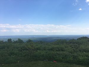
The Delaware Water Gap National Recreation Area, which "includes nearly 70,000 acres (280 km2) of mountains, valleys and floodplains," is partially located in Monroe County. The county also has Pennsylvania state parks, such as Big Pocono State Park and parts of the Delaware State Forest, Gouldsboro State Park, and Tobyhanna State Park.
The Appalachian Trail passes through Monroe County. David Pierce wrote in the Pocono Record, "The 2,184-mile [3,515 km] public footpath—from Georgia to Maine—has a particularly scenic but rugged section that straddles Monroe County’s southern border..." He stated that "trail hiking has long been an integral part of Monroe County's identity..."
During the Revolutionary War in 1779, General John Sullivan marched his troops through Monroe County on their expedition to fight the Iroquois tribe in New York State. There are many historical markers identifying the Sullivan Trail. Sergeant Moses Fellows of the Third New Hampshire Regiment described the area as "...very poor & Barren and I think as never will Be Settled.”
The Long Pond Conservation Easement has over 10,000 acres (40 km2) of public access land with numerous trail systems. It's one of the most extensive public access trail systems in Monroe County.
Dixon Miller State Forest – this is an extensive trail system in Long Pond, PA.
Jonas Mountain Nature Preserve is over 300 acres (120 ha) of Trail system that encompasses an old mountain ridge, and Jonas Creek.
Cherry Valley National Wildlife Refuge has elaborate Trail systems, and public access.
Mount Wismer is a scenic hike in Monroe County.
Nothstein Preserve is an elaborate wooded trail system in the Poconos
Chestnut mountain nature preserve is a many acre preserve atop the Plateau.
Resorts
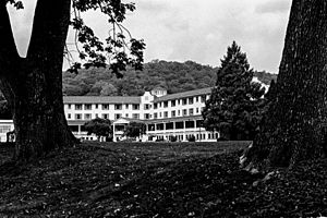
Two of the earliest Pocono resorts, founded by rival factions of the Philadelphia Quaker community, were located in Monroe County: Inn at Buck Hill Falls (1901) and Pocono Manor (1902). These resorts did not allow liquor or dancing, and evening dress was discouraged. The Quakers "brought a quiet, unostentatious style to the region," but their hotels later developed from religious retreats into "luxurious mountain resorts." Buck Hill's stone facade became a model for close to 300 stately stone-and-shingle homes in the region. Pocono Manor offers sweeping vistas of the eastern and western Pocono region and has been referred to as the "Grand Lady of the Mountains." Buck Hill closed in 1990 and the Inn at Pocono Manor was mostly destroyed by fire in 2019.
Skytop Lodge, built in 1928, is also located in Monroe County and has been described as a "Dutch Colonial-style manor house." Designed in reaction to the Quaker resorts, it had a dance floor and served liquor in a basement bar. Skytop offers thirty miles of hiking trails, and the main building "is surrounded by 5,000 acres (20 km2) of wood, glacial bogs, hemlock gorges, beaver marshes, and cascading waterfalls."
The Buckwood Inn opened in Monroe County in 1911 and included the first golf course to be designed by renowned golf architect A. W. Tillinghast. Bandleader Fred Waring purchased the resort in 1943, renamed it the Shawnee Inn, and broadcast his radio shows from there. The Shawnee Inn is a Spanish colonial revival building with white-Moorish architecture and Spanish tiled roofs, and it was identified in the 1990s as the only resort on the banks of the Delaware River.
Mount Airy Lodge, which expanded from an eight-room inn into the largest Pocono resort, was located in Monroe County. It heavily advertised in the New York media market with the catchy jingle, "Beautiful Mount Airy Lodge." Headliners, such as Bob Hope, Milton Berle, and Connie Francis, performed in the Crystal Room, Mount Airy's 2,000-seat theater. ..... The 1,200 acres (490 ha) resort's heyday was in the 1960s and 1970s before closing in 2001. In October 2007 the Mount Airy Casino Resort opened on the site.
As of July 2015, there were three resorts in Monroe County with indoor water parks: Great Wolf Lodge, Aquatopia at Camelback Resort, and Kalahari Resort.
Communities
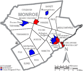
Under Pennsylvania law, there are four types of incorporated municipalities: cities, boroughs, townships, and, in at most two cases, towns. The following cities, boroughs and townships are located in Monroe County:
Boroughs
- Delaware Water Gap
- East Stroudsburg
- Mount Pocono
- Stroudsburg (county seat)
Townships
- Barrett
- Chestnuthill
- Coolbaugh
- Eldred
- Hamilton
- Jackson
- Middle Smithfield
- Paradise
- Pocono
- Polk
- Price
- Ross
- Smithfield
- Stroud
- Tobyhanna
- Tunkhannock
Census-designated places
Census-designated places are geographical areas designated by the U.S. Census Bureau for the purposes of compiling demographic data. They are not actual jurisdictions under Pennsylvania law.
- Arlington Heights
- Brodheadsville
- Effort
- Emerald Lakes
- Gouldsboro
- Indian Mountain Lake (partially in Carbon County)
- Mountainhome
- Penn Estates
- Pocono Pines
- Saw Creek (mostly in Pike County)
- Saylorsburg
- Sierra View
- Sun Valley
Unincorporated communities
- Analomink
- Appenzell
- Bartonsville
- Blakeslee
- Bossardsville
- Canadensis
- Cherry Valley
- Cresco
- Gilbert
- Gravel Place
- Hamilton Square
- Henryville
- Jonas
- Kellersville
- Kemmertown
- Kresgeville
- Kunkletown
- Long Pond
- Marshalls Creek
- McIlhaney
- McMichaels
- Meistertown
- Neola
- Paradise Valley
- Pocono Manor
- Pocono Summit
- Reeders
- Sciota
- Scotrun
- Shawnee on Delaware
- Skytop
- Snydersvillle
- South Stroudsburg
- Swiftwater
- Tannersville
- Tobyhanna
Population ranking
The population ranking of the following table is based on the 2010 census of Monroe County.
† county seat
| Rank | City/Town/etc. | Municipal type | Population (2010 Census) |
|---|---|---|---|
| 1 | East Stroudsburg | Borough | 9,840 |
| 2 | Arlington Heights | CDP | 6,333 |
| 3 | † Stroudsburg | Borough | 5,567 |
| 4 | Sierra View | CDP | 4,813 |
| 5 | Penn Estates | CDP | 4,493 |
| 6 | Indian Mountain Lake (partially in Carbon County) | CDP | 4,372 |
| 7 | Saw Creek (mostly in Pike County) | CDP | 4,016 |
| 8 | Mount Pocono | Borough | 3,170 |
| 9 | Emerald Lakes | CDP | 2,886 |
| 10 | Sun Valley | CDP | 2,399 |
| 11 | Effort | CDP | 2,269 |
| 12 | Brodheadsville | CDP | 1,800 |
| 13 | Pocono Pines | CDP | 1,409 |
| 14 | Mountainhome | CDP | 1,182 |
| 15 | Saylorsburg | CDP | 1,126 |
| 16 | Gouldsboro (mostly in Wayne County) | CDP | 890 |
| 17 | Delaware Water Gap | Borough | 746 |
Watersheds
Monroe County has three major watersheds, all of which are part of the Delaware River Watershed.
The Brodhead Watershed, the Aquashicola Pohopoco Watershed, and the Tobyhanna Tunkhannock Watershed.
Climate
Pocono Plateau Region
According to the Trewartha climate classification system, the higher elevation Pocono Plateau Region of Monroe County has a Temperate Continental climate (Dc) with warm summers (b), cold winters (o) and year-around precipitation (Dcbo). Dcbo climates are characterized by at least one month having an average mean temperature ≤ 32.0 °F (0.0 °C), four to seven months with an average mean temperature ≥ 50.0 °F (10.0 °C), all months with an average mean temperature < 72.0 °F (22.2 °C) and no significant precipitation difference between seasons. Although most summer days are comfortably humid on the Pocono Plateau, episodes of heat and high humidity can occur with heat index values > 92 °F (33 °C). Since 1981, the highest air temperature was 93.0 °F (33.9 °C) on July 15, 1995, and the highest daily average mean dew point was 70.8 °F (21.6 °C) on January 8, 2006. July is the peak month for thunderstorm activity which correlates with the average warmest month of the year. Since 1981, the wettest calendar day was 6.43 inches (163 mm) on September 30, 2010. During the winter months, the plant hardiness zone is 5b with an average annual extreme minimum air temperature of −11.2 °F (−24.0 °C). Since 1981, the coldest air temperature was −22.9 °F (−30.5 °C) on January 21, 1994. Episodes of extreme cold and wind can occur with wind chill values < −24 °F (−31 °C). The average snowiest month is January which correlates with the average coldest month of the year. Ice storms and large snowstorms depositing ≥ 12 inches (30 cm) of snow occur nearly every year, particularly during nor’easters from December through March.
| Climate data for 4 NE Tobyhanna, Elevation 2,087 ft (636 m), 1981–2010 normals, extremes 1981–2018 | |||||||||||||
|---|---|---|---|---|---|---|---|---|---|---|---|---|---|
| Month | Jan | Feb | Mar | Apr | May | Jun | Jul | Aug | Sep | Oct | Nov | Dec | Year |
| Record high °F (°C) | 60.9 (16.1) |
71.1 (21.7) |
80.3 (26.8) |
86.4 (30.2) |
88.9 (31.6) |
88.5 (31.4) |
93.0 (33.9) |
91.5 (33.1) |
89.1 (31.7) |
81.4 (27.4) |
74.8 (23.8) |
65.2 (18.4) |
93.0 (33.9) |
| Mean daily maximum °F (°C) | 29.9 (−1.2) |
33.3 (0.7) |
41.6 (5.3) |
54.3 (12.4) |
65.4 (18.6) |
73.2 (22.9) |
77.5 (25.3) |
76.0 (24.4) |
68.9 (20.5) |
57.3 (14.1) |
46.1 (7.8) |
34.3 (1.3) |
54.9 (12.7) |
| Daily mean °F (°C) | 21.9 (−5.6) |
25.0 (−3.9) |
32.3 (0.2) |
44.6 (7.0) |
55.2 (12.9) |
63.5 (17.5) |
68.1 (20.1) |
66.8 (19.3) |
59.8 (15.4) |
48.4 (9.1) |
38.5 (3.6) |
27.3 (−2.6) |
46.0 (7.8) |
| Mean daily minimum °F (°C) | 13.9 (−10.1) |
16.6 (−8.6) |
23.0 (−5.0) |
34.8 (1.6) |
45.0 (7.2) |
53.8 (12.1) |
58.7 (14.8) |
57.6 (14.2) |
50.7 (10.4) |
39.5 (4.2) |
30.9 (−0.6) |
20.3 (−6.5) |
37.2 (2.9) |
| Record low °F (°C) | −22.9 (−30.5) |
−14.1 (−25.6) |
−9.0 (−22.8) |
10.7 (−11.8) |
27.5 (−2.5) |
33.2 (0.7) |
38.1 (3.4) |
34.3 (1.3) |
28.2 (−2.1) |
17.9 (−7.8) |
−0.7 (−18.2) |
−16.2 (−26.8) |
−22.9 (−30.5) |
| Average precipitation inches (mm) | 3.66 (93) |
3.31 (84) |
4.27 (108) |
4.54 (115) |
4.67 (119) |
5.13 (130) |
4.78 (121) |
4.32 (110) |
5.14 (131) |
5.31 (135) |
4.44 (113) |
4.25 (108) |
53.82 (1,367) |
| Average snowfall inches (cm) | 20.9 (53) |
15.0 (38) |
15.6 (40) |
3.7 (9.4) |
0.0 (0.0) |
0.0 (0.0) |
0.0 (0.0) |
0.0 (0.0) |
0.0 (0.0) |
0.1 (0.25) |
3.9 (9.9) |
12.5 (32) |
71.7 (182) |
| Average relative humidity (%) | 76.0 | 70.3 | 66.5 | 62.3 | 64.9 | 74.1 | 74.0 | 77.1 | 78.5 | 75.2 | 74.2 | 77.8 | 72.6 |
| Average dew point °F (°C) | 15.5 (−9.2) |
16.7 (−8.5) |
22.4 (−5.3) |
32.5 (0.3) |
43.6 (6.4) |
55.1 (12.8) |
59.5 (15.3) |
59.4 (15.2) |
53.1 (11.7) |
40.9 (4.9) |
31.0 (−0.6) |
21.3 (−5.9) |
37.7 (3.2) |
| Source: PRISM | |||||||||||||
Ridge and Valley Region
According to the Trewartha climate classification system, the lower elevation Ridge and Valley section of Monroe County has a Temperate Continental climate (Dc) with hot summers (a), cold winters (o) and year-around precipitation (Dcao). Dcao climates are characterized by at least one month having an average mean temperature ≤ 32.0 °F (0.0 °C), four to seven months with an average mean temperature ≥ 50.0 °F (10.0 °C), at least one month with an average mean temperature ≥ 72.0 °F (22.2 °C) and no significant precipitation difference between seasons. Although most summer days are slightly humid in the Ridge and Valley, episodes of heat and high humidity can occur with heat index values > 102 °F (39 °C). Since 1981, the highest air temperature was 100.3 °F (37.9 °C) on July 22, 2011, and the highest daily average mean dew point was 72.7 °F (22.6 °C) on January 8, 2006. July is the peak month for thunderstorm activity which correlates with the average warmest month of the year. The average wettest month is September which correlates with tropical storm remnants during the peak of the Atlantic hurricane season. Since 1981, the wettest calendar day was 6.36 inches (162 mm) on August 10, 2005. During the winter months, the plant hardiness zone is 6a with an average annual extreme minimum air temperature of −5.4 °F (−20.8 °C). Since 1981, the coldest air temperature was −18.0 °F (−27.8 °C) on January 21, 1994. Episodes of extreme cold and wind can occur with wind chill values < −17 °F (−27 °C). The average snowiest month is January which correlates with the average coldest month of the year. Ice storms and large snowstorms depositing ≥ 12 inches (30 cm) of snow occur once every couple of years, particularly during nor’easters from December through March.
| Climate data for East Stroudsburg, Elevation 531 ft (162 m), 1981–2010 normals, extremes 1981–2018 | |||||||||||||
|---|---|---|---|---|---|---|---|---|---|---|---|---|---|
| Month | Jan | Feb | Mar | Apr | May | Jun | Jul | Aug | Sep | Oct | Nov | Dec | Year |
| Record high °F (°C) | 68.6 (20.3) |
77.0 (25.0) |
86.3 (30.2) |
94.4 (34.7) |
94.5 (34.7) |
95.3 (35.2) |
100.3 (37.9) |
98.7 (37.1) |
96.3 (35.7) |
87.9 (31.1) |
79.5 (26.4) |
71.1 (21.7) |
100.3 (37.9) |
| Mean daily maximum °F (°C) | 36.1 (2.3) |
39.8 (4.3) |
48.8 (9.3) |
61.6 (16.4) |
71.9 (22.2) |
79.9 (26.6) |
83.9 (28.8) |
82.3 (27.9) |
75.1 (23.9) |
63.6 (17.6) |
52.3 (11.3) |
40.4 (4.7) |
61.4 (16.3) |
| Daily mean °F (°C) | 27.0 (−2.8) |
29.9 (−1.2) |
37.9 (3.3) |
49.2 (9.6) |
59.3 (15.2) |
68.0 (20.0) |
72.4 (22.4) |
70.9 (21.6) |
63.5 (17.5) |
51.9 (11.1) |
42.3 (5.7) |
31.9 (−0.1) |
50.4 (10.2) |
| Mean daily minimum °F (°C) | 17.9 (−7.8) |
20.1 (−6.6) |
27.0 (−2.8) |
36.9 (2.7) |
46.7 (8.2) |
56.1 (13.4) |
60.9 (16.1) |
59.5 (15.3) |
51.9 (11.1) |
40.3 (4.6) |
32.3 (0.2) |
23.4 (−4.8) |
39.5 (4.2) |
| Record low °F (°C) | −18.0 (−27.8) |
−8.6 (−22.6) |
−0.5 (−18.1) |
14.3 (−9.8) |
27.1 (−2.7) |
36.4 (2.4) |
42.6 (5.9) |
38.0 (3.3) |
29.8 (−1.2) |
19.8 (−6.8) |
6.1 (−14.4) |
−7.1 (−21.7) |
−18.0 (−27.8) |
| Average precipitation inches (mm) | 3.40 (86) |
2.97 (75) |
3.64 (92) |
4.11 (104) |
4.43 (113) |
4.48 (114) |
4.52 (115) |
4.41 (112) |
4.97 (126) |
4.77 (121) |
4.02 (102) |
4.09 (104) |
49.81 (1,265) |
| Average snowfall inches (cm) | 11.8 (30) |
8.5 (22) |
8.8 (22) |
2.1 (5.3) |
0.0 (0.0) |
0.0 (0.0) |
0.0 (0.0) |
0.0 (0.0) |
0.0 (0.0) |
0.1 (0.25) |
2.2 (5.6) |
7.1 (18) |
40.6 (103) |
| Average relative humidity (%) | 69.1 | 64.3 | 59.6 | 57.4 | 61.8 | 68.9 | 68.9 | 71.7 | 72.8 | 71.0 | 69.4 | 70.5 | 67.1 |
| Average dew point °F (°C) | 18.2 (−7.7) |
19.3 (−7.1) |
25.1 (−3.8) |
34.8 (1.6) |
46.2 (7.9) |
57.4 (14.1) |
61.6 (16.4) |
61.3 (16.3) |
54.6 (12.6) |
42.8 (6.0) |
33.0 (0.6) |
23.4 (−4.8) |
39.9 (4.4) |
| Source: PRISM | |||||||||||||
Ecology
Long Pond
Long Pond is an inland freshwater wetland.
The Nature Conservancy's Hauser Nature Center is a destination for hiking and ecological tourism in Long Pond.
Pocono Plateau Region
According to the A. W. Kuchler U.S. potential natural vegetation types, the higher elevation Pocono Plateau Region of Monroe County would have a dominant vegetation type of Northern Hardwood (106) with a dominant vegetation form of Northern hardwood forest (26). The peak spring bloom typically occurs in early-May and peak fall color usually occurs in early-October. The plant hardiness zone is 5b with an average annual extreme minimum air temperature of −11.2 °F (−24.0 °C).
Ridge and Valley Region
According to the A. W. Kuchler U.S. potential natural vegetation types, the lower elevation Ridge and Valley section of Monroe County would have a dominant vegetation type of Appalachian Oak (104) with a dominant vegetation form of Eastern Hardwood Forest (25). The peak spring bloom typically occurs in late-April and peak fall color usually occurs in mid-October. The plant hardiness zone is 6a with an average annual extreme minimum air temperature of −5.4 °F (−20.8 °C).
Glacial Till Barrens
Located in the vicinity of Big Pocono State Park, Blakeslee, and Long pond. The Glacial Till Barrens are best exeplified by the Long Pond Conservation Easement. Which has public access trail systems. Glacial Till Barrens are found in Dixon Miller State Forest, and within the Bethlehem Authority property. One of the only such ecosystems in the entire state of Pennsylvania. The Glacial till barrens are mesic (meaning moist), and yet have species that are more typical of far northern climates.
See also
 In Spanish: Condado de Monroe (Pensilvania) para niños


