Milladore, Wisconsin facts for kids
Quick facts for kids
Milladore, Wisconsin
|
|
|---|---|
|
Village
|
|

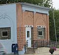
Looking west in downtown Milladore
|
|

Location of Milladore in Portage County, Wisconsin.
|
|
| Country | |
| State | |
| Counties | Wood, Portage |
| Area | |
| • Total | 1.00 sq mi (2.58 km2) |
| • Land | 1.00 sq mi (2.58 km2) |
| • Water | 0.00 sq mi (0.00 km2) |
| Elevation | 1,194 ft (364 m) |
| Population
(2010)
|
|
| • Total | 276 |
| • Estimate
(2019)
|
261 |
| • Density | 261.52/sq mi (101.00/km2) |
| Time zone | UTC-6 (Central (CST)) |
| • Summer (DST) | UTC-5 (CDT) |
| Zip code |
54454
|
| Area code(s) | 715 & 534 |
| FIPS code | 55-51875 |
| GNIS feature ID | 1569499 |
| Website | http://www.villageofmilladore.com |
Milladore is a village in Wood County and overlapping into Portage County in the U.S. state of Wisconsin. The population was 276 at the 2010 census. Most of the village is located within the Town of Milladore in Wood County, while only a very small portion of the village lies in Portage County. All of its 2010 census population resided in the Wood County portion of the village.
History
Milladore was platted in 1877. According to one tradition, an early postmaster selected the name from his reading material, while another tradition states the village was named after a train car. A post office called Milladore has been in operation since 1875.
Geography
Milladore is located at 44°36′15″N 89°51′8″W / 44.60417°N 89.85222°W (44.604282, -89.852281).
According to the United States Census Bureau, the village has a total area of 1.02 square miles (2.64 km2), all of it land.
Demographics
| Historical population | |||
|---|---|---|---|
| Census | Pop. | %± | |
| 1940 | 226 | — | |
| 1950 | 247 | 9.3% | |
| 1960 | 239 | −3.2% | |
| 1970 | 229 | −4.2% | |
| 1980 | 250 | 9.2% | |
| 1990 | 314 | 25.6% | |
| 2000 | 268 | −14.6% | |
| 2010 | 276 | 3.0% | |
| 2019 (est.) | 261 | −5.4% | |
| U.S. Decennial Census | |||
2010 census
As of the census of 2010, there were 276 people, 106 households, and 73 families living in the village. The population density was 270.6 inhabitants per square mile (104.5/km2). There were 114 housing units at an average density of 111.8 per square mile (43.2/km2). The racial makeup of the village was 93.1% White, 1.1% African American, 5.1% from other races, and 0.7% from two or more races. Hispanic or Latino of any race were 6.9% of the population.
There were 106 households, of which 35.8% had children under the age of 18 living with them, 60.4% were married couples living together, 4.7% had a female householder with no husband present, 3.8% had a male householder with no wife present, and 31.1% were non-families. 27.4% of all households were made up of individuals, and 10.4% had someone living alone who was 65 years of age or older. The average household size was 2.60 and the average family size was 3.21.
The median age in the village was 35 years. 26.1% of residents were under the age of 18; 8.7% were between the ages of 18 and 24; 26% were from 25 to 44; 27.9% were from 45 to 64; and 11.2% were 65 years of age or older. The gender makeup of the village was 54.0% male and 46.0% female.
Notable people
- Amy Sue Vruwink, politician
Images for kids
See also
 In Spanish: Milladore (Wisconsin) para niños


