Metonga Lake facts for kids
Quick facts for kids Metonga Lake |
|
|---|---|
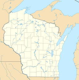
| Location | Forest County, Wisconsin |
| Coordinates | 45°32′27″N 88°54′15″W / 45.5409232°N 88.9041457°W |
| Basin countries | United States |
| Surface area | 2,038 acres (3.184 sq mi; 8.25 km2) |
| Average depth | 25 ft (7.6 m) |
| Max. depth | 79 ft (24 m) |
| Water volume | 54,547 acre⋅ft (67,283,000 m3) |
| Shore length1 | 7.9 mi (12.7 km) |
| Surface elevation | 1,598 feet (487 m) |
| Settlements | Crandon |
| 1 Shore length is not a well-defined measure. | |
Metonga Lake is a lake located in Forest County, Wisconsin. The lake has a surface area of 2,038 acres (8.25 km2) and a max depth of 79 ft (24 m). Metonga Lake is a drainage lake with a mostly sand and gravel bottom. The city of Crandon is located on the northern shore of the lake. The Crandon Municipal Airport lies on the southwestern shore.

All content from Kiddle encyclopedia articles (including the article images and facts) can be freely used under Attribution-ShareAlike license, unless stated otherwise. Cite this article:
Metonga Lake Facts for Kids. Kiddle Encyclopedia.


