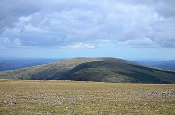
Meikle Millyea facts for kids
Quick facts for kids Meikle Millyea |
|
|---|---|
 |
|
| Highest point | |
| Elevation | 748.6 m (2,456 ft) |
| Prominence | 121 m (397 ft) |
| Listing | Hu,Tu,Sim, D,GT,DN,Y |
| Naming | |
| English translation | Scots, Scottish Gaelic: Large, Grey Round Hill |
| Geography | |
| Location | Dumfries and Galloway, Scotland |
| Parent range | Rhinns of Kells, Southern Uplands |
| OS grid | NX 51616 82555 |
| Topo map | OS Landranger 77 |
Meikle Millyea is a hill in the Rhinns of Kells, a sub-range of the Galloway Hills range, part of the Southern Uplands of Scotland. The true summit of the hill has been disputed over the years; a 2015 survey concluded that the southwest top, around 400m southwest from the trig point and cairn is approximately 2m higher.

All content from Kiddle encyclopedia articles (including the article images and facts) can be freely used under Attribution-ShareAlike license, unless stated otherwise. Cite this article:
Meikle Millyea Facts for Kids. Kiddle Encyclopedia.