McNair, Virginia facts for kids
Quick facts for kids
McNair, Virginia
|
|
|---|---|

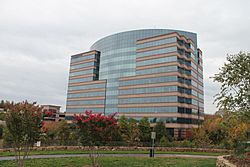
Buildings in Dulles Corner
|
|
| Country | United States |
| State | Virginia |
| County | Fairfax |
| Area | |
| • Total | 2.06 sq mi (5.33 km2) |
| • Land | 2.04 sq mi (5.29 km2) |
| • Water | 0.02 sq mi (0.05 km2) |
| Elevation | 340 ft (100 m) |
| Population
(2020)
|
|
| • Total | 21,598 |
| • Density | 10,577/sq mi (4,083.8/km2) |
| Time zone | UTC−5 (Eastern (EST)) |
| • Summer (DST) | UTC−4 (EDT) |
| ZIP code |
20171
|
| FIPS code | 51-48450 |
| GNIS feature ID | 2584871 |
McNair is a census-designated place located in the Oak Hill section of Fairfax County, Virginia, United States. It is directly to the east of Washington Dulles International Airport. The population as of the 2020 census was 21,598. Much of the population resides in the McNair Farms planned community. The community has a school called McNair Elementary.
McNair is also home to the Dulles Corner Business Park, home to the headquarters of Airbus Group, Inc. and Northrop Grumman Technical Services.
Contents
Demographics
2020 Census
As of the 2020 census (some information from the 2022 American Community Survey) there were 21,598 people, 9,673 housing units and 8,759 households residing in the CDP. The population density was 10,484.5 inhabitants per square mile (4,082.8/km2). The average housing unit density was 4,695.5 per square mile (1,828.5km2). The racial makeup of the CDP was 25.21% White, 17.04% African American, 0.40% Native American, 44.07% Asian, 0.03% Pacific Islander, 5.29% from other races, and 6.96% from two or more races. Hispanic or Latino of any race was 14.44% of the population.
Of the total households, 44.6% were married couples, 25.7% were a male householder with no spouse but a family, and 20.5% were a female householder with no spouse but a family. The average family household had 3.30 people.
The median age was 30.9, 21.1% of people were under the age of 18, and 3.7% were 65 years of age or older. Of the residents, 2.8% had Italian ancestry, 56.9% spoke a language other than English at home, and 43.6% were born outside the United States, 30.1% of whom were naturalized citizens.
The median income for a household in the CDP was $115,696, and the median income for a family was $119,628. 5.3% of the population were military veterans, and 42.2% had a batchelors degree or higher. In the CDP 6.8% of the population was below the poverty line, including 10.7% of those under age 18 and 4.1% of those age 65 or over, with 13.2% of the population without health insurance.
2010 Census
The population as of the 2010 census was 17,513.
Geography
| Historical population | |||
|---|---|---|---|
| Census | Pop. | %± | |
| 2010 | 17,513 | — | |
| 2020 | 21,598 | 23.3% | |
| 2020 Census Data | |||
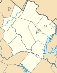
The CDP is in northwestern Fairfax County, bordered to the northeast by the town of Herndon, to the east by Reston, to the south by Floris, and to the northwest by Loudoun County. The Dulles Toll Road (Virginia State Route 267) forms the northern edge of the CDP, and Virginia State Route 28 (Sully Road) forms part of the western border. Via the Dulles Toll Road and Interstate 66 it is 25 miles (40 km) east to downtown Washington, D.C.
According to the U.S. Census Bureau, the McNair CDP has a total area of 2.0 square miles (5.3 km2), of which 0.02 square miles (0.05 km2), or 0.85%, is water.
See also
 In Spanish: McNair (Virginia) para niños


