McGuire Reservoir facts for kids
Quick facts for kids McGuire Reservoir |
|
|---|---|
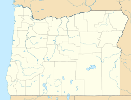
| Location | Yamhill County, Oregon, United States |
| Coordinates | 45°18′00″N 123°24′02″W / 45.30000°N 123.40056°W |
| Basin countries | United States |
| Surface area | 136.4 acres (55.2 ha) |
| Water volume | 9,800 acre-feet (12,100,000 m3) |
| Shore length1 | 4.8 miles (7.7 km) |
| Surface elevation | 1,893 feet (577 m) |
| 1 Shore length is not a well-defined measure. | |
McGuire Reservoir is an impoundment of the upper Nestucca River in Yamhill County in the U.S. state of Oregon. It is the primary raw water source for McMinnville Water and Light, which supplies drinking water to the city of McMinnville.
Before a 21st-century project expanded the reservoir, it had a surface area of about 136 acres (55 ha) and a shoreline of about 4.8 miles (7.7 km). The expansion increased the holding capacity of the reservoir from 3,760 acre-feet (4,640,000 m3) to 9,800 acre-feet (12,100,000 m3).

All content from Kiddle encyclopedia articles (including the article images and facts) can be freely used under Attribution-ShareAlike license, unless stated otherwise. Cite this article:
McGuire Reservoir Facts for Kids. Kiddle Encyclopedia.


