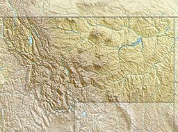
McClintock Peak facts for kids
Quick facts for kids McClintock Peak |
|
|---|---|
| Highest point | |
| Elevation | 8,290 ft (2,530 m) |
| Prominence | 365 ft (111 m) |
| Geography | |
| Location | Flathead County, Montana, Glacier County, Montana, U.S. |
| Parent range | Lewis Range |
| Topo map | USGS Cut Bank Pass, MT |
McClintock Peak (8,290 feet (2,527 m)) is located in the Lewis Range, Glacier National Park in the U.S. state of Montana. McClintock Peak is situated along the Continental Divide. The Lake of the Seven Winds sits below the east slopes of the peak and Mount Morgan is .56 mi (0.90 km) to the south.
See also
 In Spanish: Pico McClintock para niños

All content from Kiddle encyclopedia articles (including the article images and facts) can be freely used under Attribution-ShareAlike license, unless stated otherwise. Cite this article:
McClintock Peak Facts for Kids. Kiddle Encyclopedia.

