Matanuska Glacier facts for kids
Quick facts for kids Matanuska Glacier |
|
|---|---|

Matanuska Glacier
|
|
| Type | Mountain glacier |
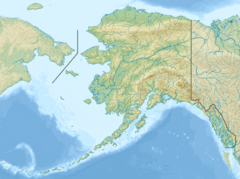
| Coordinates | 61°39′21″N 147°34′52″W / 61.65583°N 147.58111°W |
| Length | 27 miles (43 km) |
| Terminus | Matanuska River |
| Status | Retreating |
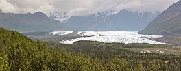
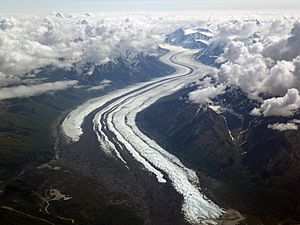
Matanuska Glacier is a valley glacier in the US state of Alaska. At 27 miles (43 km) long by 4 miles (6.4 km) wide, it is the largest glacier accessible by car in the United States. Its terminus feeds the Matanuska River. It lies near the Glenn Highway about 100 miles (160 km) north-east of Anchorage in Glacier View. Matanuska Glacier flows about 1 foot (30 cm) per day. Due to ablation of the lower glacier, as of 2007[update], the location of the glacier terminus changed little over the previous three decades.
Nearby State Park: There is an Alaska State Parks facility, the Matanuska Glacier State Recreation Site, a 229 acres (93 ha) park with trails and a small campground.
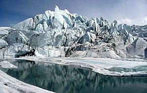
Vehicle & Walking Access: As the largest glacier in Alaska accessible by car, travelers do have options for up-close viewing or walking on the ice. Matanuska Glacier is accessible by a single road, S Glacier Park Road found at Mile 102 of the Glenn Highway. This gravel road with small bridge crossing comes to an electronic gate operated by Glacier Tours on the Matanuska. Glacier Tours also maintains the remainder of the drive to the glacier, as well as parking, a shelter, paths and picnic tables. Visitors may pay a nominal fee for self-guided day-long touring (available in summer only), or partake in a guided glacier tour with the gate operator or other guides in the area. Local tours are operated year-round. Additional tours depart from Downtown Anchorage and include a guide with shuttle service to Matanuska Glacier.
Fun Fact: The glacier is the eponym of the Alaska Marine Highway ferry M/V Matanuska.
See also
 In Spanish: Glaciar Matanuska para niños


