Marshall County, Tennessee facts for kids
Quick facts for kids
Marshall County
|
|
|---|---|

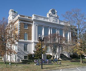
Marshall County Courthouse in Lewisburg
|
|

Location within the U.S. state of Tennessee
|
|
 Tennessee's location within the U.S. |
|
| Country | |
| State | |
| Founded | February 20, 1836 |
| Named for | John Marshall |
| Seat | Lewisburg |
| Largest city | Lewisburg |
| Area | |
| • Total | 376 sq mi (970 km2) |
| • Land | 375 sq mi (970 km2) |
| • Water | 0.7 sq mi (2 km2) 0.2%% |
| Population
(2020)
|
|
| • Total | 34,318 |
| • Density | 82/sq mi (32/km2) |
| Time zone | UTC−6 (Central) |
| • Summer (DST) | UTC−5 (CDT) |
| Congressional district | 5th |
Marshall County is a county located in the U.S. state of Tennessee. As of the 2020 census, the population was 34,318. Its county seat is Lewisburg. Marshall County comprises the Lewisburg Micropolitan Statistical Area, which is also included in the Nashville-Davidson–Murfreesboro–Franklin, TN Metropolitan Statistical Area. It is in Middle Tennessee, one of the three Grand Divisions of the state.
The Tennessee Walking Horse Breeders' and Exhibitors' Association is based here. In addition, the fainting goat is another animal breed developed here. To celebrate this unique breed, the county holds an annual festival known as "Goats, Music and More," drawing visitors from around the world.
Contents
History
Marshall County was created in 1836 from parts of Giles, Bedford, Lincoln and Maury counties, and was named after the American jurist, John Marshall, Chief Justice of the U.S. Supreme Court.
Three Tennessee governors— Buford Ellington, Henry Hollis Horton, and Jim Nance McCord— lived in Marshall County at the time of their run for governor.
Geography
According to the U.S. Census Bureau, the county has a total area of 376 square miles (970 km2), of which 375 square miles (970 km2) is land and 0.7 square miles (1.8 km2) (0.2%) is water. The Duck River drains much of the county.
Adjacent counties
- Rutherford County (northeast)
- Bedford County (east)
- Lincoln County (southeast)
- Giles County (southwest)
- Maury County (west)
- Williamson County (northwest)
State protected areas
- Henry Horton State Park
- Wilson School Road Forest and Cedar Glades State Natural Area
Demographics
| Historical population | |||
|---|---|---|---|
| Census | Pop. | %± | |
| 1840 | 14,555 | — | |
| 1850 | 15,616 | 7.3% | |
| 1860 | 14,592 | −6.6% | |
| 1870 | 16,207 | 11.1% | |
| 1880 | 19,259 | 18.8% | |
| 1890 | 18,906 | −1.8% | |
| 1900 | 18,763 | −0.8% | |
| 1910 | 16,872 | −10.1% | |
| 1920 | 17,375 | 3.0% | |
| 1930 | 15,574 | −10.4% | |
| 1940 | 16,030 | 2.9% | |
| 1950 | 17,768 | 10.8% | |
| 1960 | 16,859 | −5.1% | |
| 1970 | 17,319 | 2.7% | |
| 1980 | 19,698 | 13.7% | |
| 1990 | 21,539 | 9.3% | |
| 2000 | 26,767 | 24.3% | |
| 2010 | 30,617 | 14.4% | |
| 2020 | 34,318 | 12.1% | |
| U.S. Decennial Census 1790–1960, 1900–1990, 1990–2000, 2010-2014 |
|||
2020 census
| Race | Number | Percentage |
|---|---|---|
| White (non-Hispanic) | 28,255 | 82.33% |
| Black or African American (non-Hispanic) | 2,018 | 5.88% |
| Native American | 103 | 0.3% |
| Asian | 142 | 0.41% |
| Pacific Islander | 7 | 0.02% |
| Other/Mixed | 1,558 | 4.54% |
| Hispanic or Latino | 2,235 | 6.51% |
As of the 2020 United States census, there were 34,318 people, 12,324 households, and 8,624 families residing in the county.
Communities
City
Towns
- Chapel Hill
- Cornersville
- Petersburg (partial)
Unincorporated communities
See also
 In Spanish: Condado de Marshall (Tennessee) para niños


