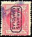
Mariana Islands facts for kids
The Mariana Islands (also the Marianas; up to the early 20th century sometimes called Islas de los Ladrones meaning "Islands of Thieves") are a group of islands made up by the summits of 15 volcanic mountains in the western Pacific Ocean.
They are the southern part of a seamount range that goes on for 1,565 miles (2,519 km) from Guam to near Japan. The Marianas are the northernmost islands of a larger island group called Micronesia. The Marianas have a total land area of 396 square miles (1026 km²) and are composed of two administrative units:
- Guam is a US territory
- the Northern Mariana Islands (including the islands of Saipan, Tinian and Rota) comprise a Commonwealth of the United States.
The first European to discover the island group was Ferdinand Magellan in 1521. In 1667 Spain formally claimed them, and named them after Spanish Queen Mariana of Austria.
Images for kids
-
Ruins of Guma Taga on Tinian. The pillars/columns are called latte (pronounced læ'di) stones, a common architectural element of prehistoric structures in the Mariana Islands, upon which elevated buildings were built. Earthquakes had toppled the other latte at this site by the time this photo was taken; an earthquake in 1902 toppled the one seen on the left, and today only the one on the right remains standing.
-
Reception of the Manila Galleon by the Chamorro in the Ladrones Islands, ca. 1590 Boxer Codex
See also
 In Spanish: Islas Marianas para niños


