Maple Mountain (British Columbia) facts for kids
This article is about Maple Mountain (disambiguation)|Maple Mountain. For other uses, see Maple Mountain (British Columbia) (disambiguation).
Quick facts for kids Maple Mountain |
|
|---|---|
| Highest point | |
| Elevation | 506 m (1,660 ft) |
| Prominence | 476 m (1,562 ft) |
| Geography | |
| Location | British Columbia, Canada |
| Parent range | Vancouver Island Ranges |
| Topo map | NTS 92B/13 |
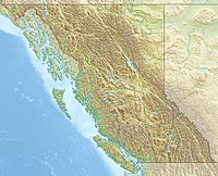
Maple Mountain is a mountain on Vancouver Island in British Columbia, Canada. The mountain is located on the northern side of Maple Bay in North Cowichan, just NE of the city of Duncan.
There is a marked hiking trail that goes up Maple Mountain and affords great views of the water, Salt Spring Island and the distant snowy peaks of the mainland. To get to the trailhead, follow Osborne Bay Road north toward Crofton and turn right on Chilco Road. Follow Chilco to the very end and park there. Walk past the yellow gate. Blue flagging tape marks the trail, which is well maintained.

All content from Kiddle encyclopedia articles (including the article images and facts) can be freely used under Attribution-ShareAlike license, unless stated otherwise. Cite this article:
Maple Mountain (British Columbia) Facts for Kids. Kiddle Encyclopedia.
