Manitou River (Minnesota) facts for kids
Quick facts for kids Manitou River |
|
|---|---|

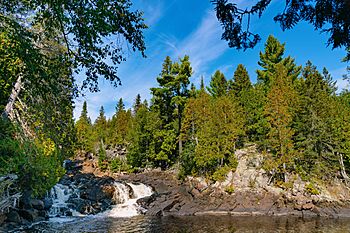
A waterfall on the Manitou River
|
|
|
Mouth of the Manitou River
|
|
| Country | United States |
| State | Minnesota |
| County | Lake County |
| Physical characteristics | |
| Main source | Delay Lake, east of Isabella, Minnesota 1,953 feet (595 m) 47°36′23″N 91°17′31″W / 47.6062959°N 91.291816°W |
| River mouth | Lake Superior 602 feet (183 m) 47°26′34″N 91°03′50″W / 47.4427°N 91.0640°W |
| Length | 24.9-mile-long (40.1 km) |
| Basin features | |
| Tributaries |
|
| Waterfalls | Manitou River Cascades |
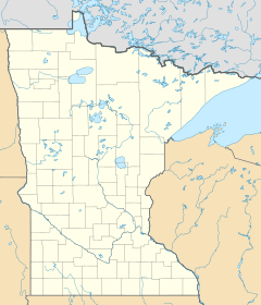
The Manitou River is a 24.9-mile-long (40.1 km) river in northern Minnesota, which drains into Lake Superior along its north shore about three miles northeast of Little Marais. It flows southeast through the Superior National Forest, Finland State Forest, and George H. Crosby Manitou State Park in Lake County.
The Caribou River watershed is adjacent to the east, while to the west is the Baptism River. The Isabella River, which is a part of the Hudson Bay watershed, is to the north across the Laurentian Divide.
The Superior Hiking Trail crosses the Manitou River within George H. Crosby Manitou State Park.
The Manitou River contains rainbow trout and brook trout.

All content from Kiddle encyclopedia articles (including the article images and facts) can be freely used under Attribution-ShareAlike license, unless stated otherwise. Cite this article:
Manitou River (Minnesota) Facts for Kids. Kiddle Encyclopedia.

