Maniitsoq Island facts for kids
This page is about the island in the Davis Strait area. For the island in the Upernavik Archipelago, see Maniitsoq Island (Upernavik Archipelago).

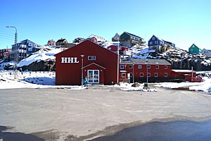
View of Maniitsoq town
|
|
| Geography | |
|---|---|
| Location | Davis Strait |
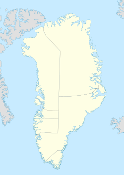
| Coordinates | 65°28′00″N 52°59′00″W / 65.46667°N 52.98333°W |
| Highest elevation | 216 m (709 ft) |
| Administration | |
|
Greenland
|
|
| Municipality | Qeqqata |
| Demographics | |
| Population | 2670 (2013) |
Maniitsoq Island is an island in the Qeqqata municipality in western Greenland.
Geography
The island is located on the shores of Davis Strait, separated from Sermersuut Island in the north by the Ammarqoq Sound. The island is roughly triangular in shape and many little islets and rocks dot its eastern and southwestern coastline.
Located at the southern end of the island, Maniitsoq was formerly known as Sukkertoppen. It is the only settlement in the area and is served by the Maniitsoq Airport.

All content from Kiddle encyclopedia articles (including the article images and facts) can be freely used under Attribution-ShareAlike license, unless stated otherwise. Cite this article:
Maniitsoq Island Facts for Kids. Kiddle Encyclopedia.
