Magdalena River facts for kids
Quick facts for kids Magdalena |
|
| River | |
|
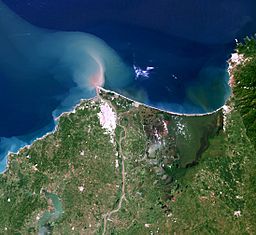
The delta of the Magdalena River
|
|
| Name origin: Biblical figure Mary Magdalene | |
| Country | Colombia |
|---|---|
| Tributaries | |
| - left | Páez River, Saldaña River, La Miel River, Nare River, Cauca River, San Jorge River |
| - right | Cabrera River, Bogotá River, Negro River, Carare River, Sogamoso River, Cesar River |
| Cities | Neiva, Girardot, Honda, La Dorada, Puerto Boyacá, Puerto Berrío, Barrancabermeja, Santa Cruz de Mompox, Magangué, Barranquilla |
| Source | La Magdalena lagoon |
| - location | Colombian Massif, Colombia |
| - elevation | 3,685 m (12,090 ft) |
| - coordinates | 1°56′3″N 76°36′29″W / 1.93417°N 76.60806°W |
| Mouth | Caribbean Sea |
| - location | Baranquilla, Colombia |
| - elevation | 0 m (0 ft) |
| - coordinates | 11°7′0″N 74°51′0″W / 11.11667°N 74.85000°W |
| Length | 1,528 km (949 mi) |
| Basin | 257,438 km² (99,397 sq mi) |
| Discharge | for Calamar, Bolívar |
| - average | 7,200 m³/s (254,300 cu ft/s) |
| - max | 12,000 m³/s (423,800 cu ft/s) |
| - min | 2,000 m³/s (70,600 cu ft/s) |
The Magdalena River is the most important river in the western part of Colombia. It has a length of 1,538 kilometres (956 mi). Its course is from south to north. About 80 percent of the population of Colombia live on the banks of the river or one of its tributaries. Barranquilla, Colombia's biggest city, lies on the banks of the river. The river is navigable up to the city of Honda, about 1,000 kilometres (620 mi) upstream. At Honda, there are rapids. After these rapids, the river is navigable for another 240 kilometres (150 mi).
Images for kids
-
Magdalena River in Cundinamarca–Tolima
-
Champán on the Magdalena, c. 1860, aquatint by Ramón Torres Méndez
See also
 In Spanish: Río Magdalena para niños

All content from Kiddle encyclopedia articles (including the article images and facts) can be freely used under Attribution-ShareAlike license, unless stated otherwise. Cite this article:
Magdalena River Facts for Kids. Kiddle Encyclopedia.


